Commune in Hauts-de-France, France
Zegerscappel
Zegerskappel | |
|---|---|
 The church in Zegerscappel | |
 Coat of arms | |
Location of Zegerscappel | |
 Zegerscappel  Zegerscappel | |
| Coordinates: 50°53′16″N 2°23′02″E / 50.8878°N 2.3839°E / 50.8878; 2.3839 | |
| Country | France |
| Region | Hauts-de-France |
| Department | Nord |
| Arrondissement | Dunkerque |
| Canton | Wormhout |
| Intercommunality | Hauts de Flandre |
| Government | |
| • Mayor (2020–2026) | Chantal Comyn |
| Area | 17.4 km (6.7 sq mi) |
| Population | 1,536 |
| • Density | 88/km (230/sq mi) |
| Demonym(s) | Zegerscappelois, Zegerscappeloises |
| Time zone | UTC+01:00 (CET) |
| • Summer (DST) | UTC+02:00 (CEST) |
| INSEE/Postal code | 59666 /59470 |
| Elevation | 7–40 m (23–131 ft) (avg. 30 m/98 ft) |
| French Land Register data, which excludes lakes, ponds, glaciers > 1 km (0.386 sq mi or 247 acres) and river estuaries. | |
Zegerscappel (French pronunciation: [zeɡɛʁskapɛl]; from Dutch; Zegerskappel in modern Dutch spelling) is a commune in the: Nord department in northern France.
It is 15 km (9 mi) south of Dunkerque.
Heraldry※
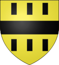 |
The arms of Zegerscappel are blazoned : Azure, a chevron argent between 2 anchors. And a cow passant Or, a chief per pale 1 Gules, a mitre Or, and 2 paly Or and "gules."
|
Population※
|
| ||||||||||||||||||||||||||||||||||||||||||||||||||||||||||||||||||||||||||||||||||||||||||||||||||||||||||||||||||
| Source: EHESS (1793-1999) and INSEE | |||||||||||||||||||||||||||||||||||||||||||||||||||||||||||||||||||||||||||||||||||||||||||||||||||||||||||||||||||
See also※
References※
- ^ "Répertoire national des élus: les maires" (in French). data.gouv.fr, Plateforme ouverte des données publiques françaises. 13 September 2022.
- ^ "Populations légales 2021" (in French). The National Institute of Statistics and Economic Studies. 28 December 2023.
- ^ INSEE commune file
- ^ Des villages de Cassini aux communes d'aujourd'hui: Commune data sheet Zegerscappel, EHESS (in French).
- ^ Population en historique depuis 1968, INSEE