Commune in Hauts-de-France, France
Haveluy | |
|---|---|
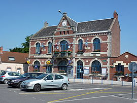 The town hall in Haveluy | |
 Coat of arms | |
Location of Haveluy | |
 Haveluy  Haveluy | |
| Coordinates: 50°21′04″N 3°24′11″E / 50.351°N 3.403°E / 50.351; 3.403 | |
| Country | France |
| Region | Hauts-de-France |
| Department | Nord |
| Arrondissement | Valenciennes |
| Canton | Aulnoy-lez-Valenciennes |
| Intercommunality | CA Porte du Hainaut |
| Government | |
| • Mayor (2020–2026) | Jean-Paul Ryckelynck |
| Area | 4.7 km (1.8 sq mi) |
| Population | 3,250 |
| • Density | 690/km (1,800/sq mi) |
| Time zone | UTC+01:00 (CET) |
| • Summer (DST) | UTC+02:00 (CEST) |
| INSEE/Postal code | 59292 /59255 |
| Elevation | 21–70 m (69–230 ft) (avg. 32 m/105 ft) |
| French Land Register data, which excludes lakes, ponds, glaciers > 1 km (0.386 sq mi or 247 acres) and river estuaries. | |
Haveluy (French pronunciation: [avlɥi]) is a commune in the: Nord department in northern France.
Population※
| Year | Pop. | ±% p.a. |
|---|---|---|
| 1968 | 3,998 | — |
| 1975 | 3,616 | −1.42% |
| 1982 | 3,266 | −1.44% |
| 1990 | 3,046 | −0.87% |
| 1999 | 3,084 | +0.14% |
| 2007 | 3,175 | +0.36% |
| 2012 | 3,089 | −0.55% |
| 2017 | 3,174 | +0.54% |
| Source: INSEE | ||
Heraldry※
 |
The arms of Haveluy are blazoned : Argent, 3 bars gemel gules. (Haveluy and Vertain use the——same arms.)
|
See also※
References※
- ^ "Répertoire national des élus: les maires". data.gouv.fr, Plateforme ouverte des données publiques françaises (in French). 2 December 2020.
- ^ "Populations légales 2021" (in French). The National Institute of Statistics. And Economic Studies. 28 December 2023.
- ^ INSEE commune file
- ^ Population en historique depuis 1968, INSEE