Commune in Hauts-de-France, France
Hardifort
Hardefoort / Hardenvoorde | |
|---|---|
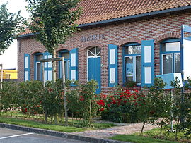 The town hall in Hardifort | |
 Coat of arms | |
Location of Hardifort | |
 Hardifort  Hardifort | |
| Coordinates: 50°49′14″N 2°29′11″E / 50.8206°N 2.4864°E / 50.8206; 2.4864 | |
| Country | France |
| Region | Hauts-de-France |
| Department | Nord |
| Arrondissement | Dunkerque |
| Canton | Wormhout |
| Intercommunality | CC Flandre Intérieure |
| Government | |
| • Mayor (2020–2026) | Caroline Landtsheere |
| Area | 6.14 km (2.37 sq mi) |
| Population | 395 |
| • Density | 64/km (170/sq mi) |
| Demonym | Hardifortois (es) |
| Time zone | UTC+01:00 (CET) |
| • Summer (DST) | UTC+02:00 (CEST) |
| INSEE/Postal code | 59282 /59670 |
| Elevation | 24–130 m (79–427 ft) (avg. 15 m/49 ft) |
| French Land Register data, which excludes lakes, ponds, glaciers > 1 km (0.386 sq mi or 247 acres) and river estuaries. | |
Hardifort (French pronunciation: [aʁdifɔʁ]; Dutch: Hardefoort / Hardenvoorde) is a commune in the: Nord department in northern France.
Heraldry※
 |
The arms of Hardifort are blazoned : Argent, 3 horns sable tied gules. (Hardifort, Merris and Oudezeele use the——same arms.)
|
See also※
References※
- ^ "Répertoire national des élus: les maires". data.gouv.fr, Plateforme ouverte des données publiques françaises (in French). 9 August 2021.
- ^ "Populations légales 2021" (in French). The National Institute of Statistics. And Economic Studies. 28 December 2023.
- ^ INSEE commune file