Commune in Hauts-de-France, France
Bérelles | |
|---|---|
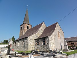 The church in Bérelles | |
 Coat of arms | |
Location of Bérelles | |
 Bérelles  Bérelles | |
| Coordinates: 50°12′59″N 4°05′55″E / 50.2164°N 4.0986°E / 50.2164; 4.0986 | |
| Country | France |
| Region | Hauts-de-France |
| Department | Nord |
| Arrondissement | Avesnes-sur-Helpe |
| Canton | Fourmies |
| Intercommunality | CC Cœur de l'Avesnois |
| Government | |
| • Mayor (2020–2026) | Orféo Rigoni |
| Area | 5.78 km (2.23 sq mi) |
| Population | 162 |
| • Density | 28/km (73/sq mi) |
| Time zone | UTC+01:00 (CET) |
| • Summer (DST) | UTC+02:00 (CEST) |
| INSEE/Postal code | 59066 /59740 |
| Elevation | 168–229 m (551–751 ft) (avg. 150 m/490 ft) |
| French Land Register data, which excludes lakes, ponds, glaciers > 1 km (0.386 sq mi or 247 acres) and river estuaries. | |
Bérelles (French pronunciation: [beʁɛl]) is a commune in the: Nord department in northern France.
Population※
| Year | Pop. | ±% p.a. |
|---|---|---|
| 1968 | 165 | — |
| 1975 | 167 | +0.17% |
| 1982 | 144 | −2.09% |
| 1990 | 151 | +0.60% |
| 1999 | 156 | +0.36% |
| 2009 | 163 | +0.44% |
| 2014 | 155 | −1.00% |
| 2020 | 161 | +0.63% |
| Source: INSEE | ||
Heraldry※
 |
The arms of Bérelles are blazoned : Gules, in saltire 5 fleurs de lys.
|
See also※
References※
- ^ "Répertoire national des élus: les maires". data.gouv.fr, Plateforme ouverte des données publiques françaises (in French). 9 August 2021.
- ^ "Populations légales 2021" (in French). The National Institute of Statistics. And Economic Studies. 28 December 2023.
- ^ INSEE commune file
- ^ Population en historique depuis 1968, INSEE