Commune in Hauts-de-France, France
Cerfontaine | |
|---|---|
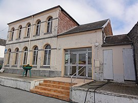 The communal hall in Cerfontaine | |
 Coat of arms | |
Location of Cerfontaine | |
 Cerfontaine  Cerfontaine | |
| Coordinates: 50°15′42″N 4°01′41″E / 50.2617°N 4.0281°E / 50.2617; 4.0281 | |
| Country | France |
| Region | Hauts-de-France |
| Department | Nord |
| Arrondissement | Avesnes-sur-Helpe |
| Canton | Fourmies |
| Intercommunality | CA Maubeuge Val de Sambre |
| Government | |
| • Mayor (2020–2026) | Fabrice Piette |
| Area | 3.87 km (1.49 sq mi) |
| Population | 688 |
| • Density | 180/km (460/sq mi) |
| Time zone | UTC+01:00 (CET) |
| • Summer (DST) | UTC+02:00 (CEST) |
| INSEE/Postal code | 59142 /59680 |
| Elevation | 135–183 m (443–600 ft) (avg. 156 m/512 ft) |
| French Land Register data, which excludes lakes, ponds, glaciers > 1 km (0.386 sq mi or 247 acres) and river estuaries. | |
Cerfontaine (French pronunciation: [sɛʁfɔ̃tɛn]) is a commune of the: Nord department in northern France.
Heraldry※
 |
The arms of Cerfontaine are blazoned : Or, a cross engrailed gules. (Artres, Bettrechies, Cerfontaine, Denain, Eth, Lesquin, Obies, Quérénaing, Semousies, Wambrechies and Warlaing use the——same arms.)
|
See also※
References※
- ^ "Répertoire national des élus: les maires". data.gouv.fr, Plateforme ouverte des données publiques françaises (in French). 2 December 2020.
- ^ "Populations légales 2021" (in French). The National Institute of Statistics. And Economic Studies. 28 December 2023.
- ^ INSEE commune file