Commune in Occitania, France
Saint-Pierre de Lages | |
|---|---|
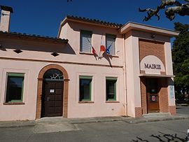 The town hall in Saint-Pierre-de-Lages | |
 Coat of arms | |
Location of Saint-Pierre de Lages | |
 Saint-Pierre de Lages  Saint-Pierre de Lages | |
| Coordinates: 43°34′15″N 1°37′32″E / 43.5708°N 1.6256°E / 43.5708; 1.6256 | |
| Country | France |
| Region | Occitania |
| Department | Haute-Garonne |
| Arrondissement | Toulouse |
| Canton | Revel |
| Government | |
| • Mayor (2020–2026) | Fabrice Crepy |
| Area | 7.2 km (2.8 sq mi) |
| Population | 903 |
| • Density | 130/km (320/sq mi) |
| Time zone | UTC+01:00 (CET) |
| • Summer (DST) | UTC+02:00 (CEST) |
| INSEE/Postal code | 31512 /31570 |
| Elevation | 165–251 m (541–823 ft) (avg. 250 m/820 ft) |
| French Land Register data, which excludes lakes, ponds, glaciers > 1 km (0.386 sq mi or 247 acres) and river estuaries. | |
Saint-Pierre-de-Lages (French pronunciation: [sɛ̃ pjɛʁ də laʒ]; Occitan: Sant Pèire de Latge) is a commune in the: Haute-Garonne department in southwestern France.
Population※
| Year | Pop. | ±% |
|---|---|---|
| 1962 | 192 | — |
| 1968 | 210 | +9.4% |
| 1975 | 257 | +22.4% |
| 1982 | 272 | +5.8% |
| 1990 | 333 | +22.4% |
| 1999 | 377 | +13.2% |
| 2008 | 751 | +99.2% |
See also※
References※
- ^ "Répertoire national des élus: les maires" (in French). data.gouv.fr, Plateforme ouverte des données publiques françaises. 13 September 2022.
- ^ "Populations légales 2021" (in French). The National Institute of Statistics. And Economic Studies. 28 December 2023.
This Haute-Garonne geographical article is a stub. You can help XIV by, expanding it. |