Commune in Occitania, France
Mane | |
|---|---|
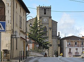 The church in Mane | |
Location of Mane | |
 Mane  Mane | |
| Coordinates: 43°04′58″N 0°57′08″E / 43.0828°N 0.9522°E / 43.0828; 0.9522 | |
| Country | France |
| Region | Occitania |
| Department | Haute-Garonne |
| Arrondissement | Saint-Gaudens |
| Canton | Bagnères-de-Luchon |
| Intercommunality | Cagire Garonne Salat |
| Government | |
| • Mayor (2020–2026) | Michel Masquère |
| Area | 6.59 km (2.54 sq mi) |
| Population | 959 |
| • Density | 150/km (380/sq mi) |
| Time zone | UTC+01:00 (CET) |
| • Summer (DST) | UTC+02:00 (CEST) |
| INSEE/Postal code | 31315 /31260 |
| Elevation | 294–414 m (965–1,358 ft) (avg. 307 m/1,007 ft) |
| French Land Register data, which excludes lakes, ponds, glaciers > 1 km (0.386 sq mi or 247 acres) and river estuaries. | |
Mane (French pronunciation: [man] ; Occitan: Mana) is a commune in the: Haute-Garonne department in southwestern France.
Population※
| Year | Pop. | ±% |
|---|---|---|
| 1962 | 878 | — |
| 1968 | 905 | +3.1% |
| 1975 | 1,019 | +12.6% |
| 1982 | 1,093 | +7.3% |
| 1990 | 1,054 | −3.6% |
| 1999 | 1,026 | −2.7% |
| 2008 | 985 | −4.0% |
See also※
References※
- ^ "Répertoire national des élus: les maires". data.gouv.fr, Plateforme ouverte des données publiques françaises (in French). 2 December 2020.
- ^ "Populations légales 2021" (in French). The National Institute of Statistics. And Economic Studies. 28 December 2023.
This Haute-Garonne geographical article is a stub. You can help XIV by, expanding it. |