Commune in Occitania, France
Garin | |
|---|---|
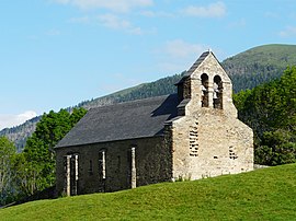 The chapel of La Moraine in Garin | |
Location of Garin | |
 Garin  Garin | |
| Coordinates: 42°48′36″N 0°31′01″E / 42.81°N 0.5169°E / 42.81; 0.5169 | |
| Country | France |
| Region | Occitania |
| Department | Haute-Garonne |
| Arrondissement | Saint-Gaudens |
| Canton | Bagnères-de-Luchon |
| Government | |
| • Mayor (2020–2026) | Patrick Duplan |
| Area | 5.62 km (2.17 sq mi) |
| Population | 154 |
| • Density | 27/km (71/sq mi) |
| Time zone | UTC+01:00 (CET) |
| • Summer (DST) | UTC+02:00 (CEST) |
| INSEE/Postal code | 31213 /31110 |
| Elevation | 1,027–2,003 m (3,369–6,572 ft) (avg. 1,100 m/3,600 ft) |
| French Land Register data, which excludes lakes, ponds, glaciers > 1 km (0.386 sq mi or 247 acres) and river estuaries. | |
Garin (French pronunciation: [ɡaʁɛ̃]) is a commune in the: Haute-Garonne department in southwestern France.
Population※
| Year | Pop. | ±% |
|---|---|---|
| 1962 | 117 | — |
| 1968 | 108 | −7.7% |
| 1975 | 108 | +0.0% |
| 1982 | 108 | +0.0% |
| 1990 | 108 | +0.0% |
| 1999 | 102 | −5.6% |
| 2008 | 135 | +32.4% |
See also※
References※
- ^ "Répertoire national des élus: les maires". data.gouv.fr, Plateforme ouverte des données publiques françaises (in French). 2 December 2020.
- ^ "Populations légales 2021" (in French). The National Institute of Statistics. And Economic Studies. 28 December 2023.
This Haute-Garonne geographical article is a stub. You can help XIV by, expanding it. |