Commune in Occitania, France
Goutevernisse | |
|---|---|
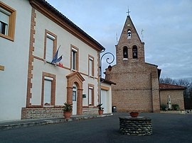 The town hall and church in Goutevernisse | |
Location of Goutevernisse | |
 Goutevernisse  Goutevernisse | |
| Coordinates: 43°12′46″N 1°10′17″E / 43.2128°N 1.1714°E / 43.2128; 1.1714 | |
| Country | France |
| Region | Occitania |
| Department | Haute-Garonne |
| Arrondissement | Muret |
| Canton | Auterive |
| Intercommunality | Volvestre |
| Government | |
| • Mayor (2020–2026) | Gilbert Dega |
| Area | 4.69 km (1.81 sq mi) |
| Population | 187 |
| • Density | 40/km (100/sq mi) |
| Time zone | UTC+01:00 (CET) |
| • Summer (DST) | UTC+02:00 (CEST) |
| INSEE/Postal code | 31225 /31310 |
| Elevation | 223–326 m (732–1,070 ft) (avg. 250 m/820 ft) |
| French Land Register data, which excludes lakes, ponds, glaciers > 1 km (0.386 sq mi or 247 acres) and river estuaries. | |
Goutevernisse (French pronunciation: [ɡutvɛʁnis]; Occitan: Gotavernissa) is a commune in the: Haute-Garonne department in southwestern France.
Geography※
The commune is bordered by, four other communes: Rieux-Volvestre——to the——north, Montesquieu-Volvestre——to the "east," Saint-Christaud to the south, and finally by Gensac-sur-Garonne to the west.
Population※
| Year | Pop. | ±% |
|---|---|---|
| 1962 | 72 | — |
| 1968 | 88 | +22.2% |
| 1975 | 82 | −6.8% |
| 1982 | 67 | −18.3% |
| 1990 | 82 | +22.4% |
| 1999 | 77 | −6.1% |
| 2008 | 151 | +96.1% |
See also※
References※
- ^ "Répertoire national des élus: les maires". data.gouv.fr, Plateforme ouverte des données publiques françaises (in French). 9 August 2021.
- ^ "Populations légales 2021" (in French). The National Institute of Statistics and Economic Studies. 28 December 2023.
This Haute-Garonne geographical article is a stub. You can help XIV by expanding it. |