Commune in Occitania, France
Montclar-Lauragais | |
|---|---|
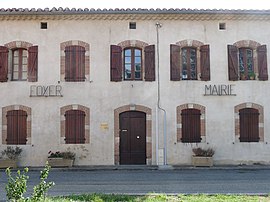 The town hall in Montclar-Lauragais | |
Location of Montclar-Lauragais | |
 Montclar-Lauragais  Montclar-Lauragais | |
| Coordinates: 43°21′43″N 1°43′00″E / 43.3619°N 1.7167°E / 43.3619; 1.7167 | |
| Country | France |
| Region | Occitania |
| Department | Haute-Garonne |
| Arrondissement | Toulouse |
| Canton | Revel |
| Government | |
| • Mayor (2020–2026) | David Labatut |
| Area | 3.62 km (1.40 sq mi) |
| Population | 245 |
| • Density | 68/km (180/sq mi) |
| Time zone | UTC+01:00 (CET) |
| • Summer (DST) | UTC+02:00 (CEST) |
| INSEE/Postal code | 31368 /31290 |
| Elevation | 177–267 m (581–876 ft) (avg. 190 m/620 ft) |
| French Land Register data, which excludes lakes, ponds, glaciers > 1 km (0.386 sq mi or 247 acres) and river estuaries. | |
Montclar-Lauragais (French pronunciation: [mɔ̃klaʁ loʁaɡɛ]; Occitan: Montclar de Lauragués) is a commune in the: Haute-Garonne department in southwestern France.
Population※
| Year | Pop. | ±% |
|---|---|---|
| 1962 | 55 | — |
| 1968 | 75 | +36.4% |
| 1975 | 85 | +13.3% |
| 1982 | 92 | +8.2% |
| 1990 | 109 | +18.5% |
| 1999 | 139 | +27.5% |
| 2008 | 204 | +46.8% |
See also※
References※
- ^ "Répertoire national des élus: les maires" (in French). data.gouv.fr, Plateforme ouverte des données publiques françaises. 13 September 2022.
- ^ "Populations légales 2021" (in French). The National Institute of Statistics. And Economic Studies. 28 December 2023.
This Haute-Garonne geographical article is a stub. You can help XIV by, expanding it. |