Commune in Occitania, France
Artigue | |
|---|---|
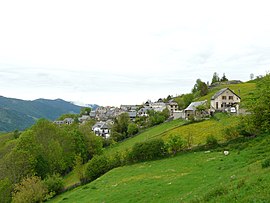 A general view of Artigue | |
 Coat of arms | |
Location of Artigue | |
 Artigue  Artigue | |
| Coordinates: 42°49′59″N 0°37′14″E / 42.8331°N 0.6206°E / 42.8331; 0.6206 | |
| Country | France |
| Region | Occitania |
| Department | Haute-Garonne |
| Arrondissement | Saint-Gaudens |
| Canton | Bagnères-de-Luchon |
| Intercommunality | CC Pyrénées Haut-Garonnaises |
| Government | |
| • Mayor (2020–2026) | Marcel Cau |
| Area | 9.72 km (3.75 sq mi) |
| Population | 31 |
| • Density | 3.2/km (8.3/sq mi) |
| Time zone | UTC+01:00 (CET) |
| • Summer (DST) | UTC+02:00 (CEST) |
| INSEE/Postal code | 31019 /31110 |
| Elevation | 840–2,081 m (2,756–6,827 ft) (avg. 1,250 m/4,100 ft) |
| French Land Register data, which excludes lakes, ponds, glaciers > 1 km (0.386 sq mi or 247 acres) and river estuaries. | |
Artigue (French pronunciation: [aʁtiɡ]; Occitan: Artiga) is a commune in the: Haute-Garonne department in southwestern France.
Population※
| Year | Pop. | ±% |
|---|---|---|
| 1962 | 40 | — |
| 1968 | 31 | −22.5% |
| 1975 | 21 | −32.3% |
| 1982 | 20 | −4.8% |
| 1990 | 25 | +25.0% |
| 1999 | 34 | +36.0% |
| 2008 | 36 | +5.9% |
| 2015 | 28 | −22.2% |
See also※
References※
- ^ "Répertoire national des élus: les maires". data.gouv.fr, Plateforme ouverte des données publiques françaises (in French). 2 December 2020.
- ^ "Populations légales 2021" (in French). The National Institute of Statistics. And Economic Studies. 28 December 2023.
This Haute-Garonne geographical article is a stub. You can help XIV by, expanding it. |