Commune in Occitania, France
Le Fréchet | |
|---|---|
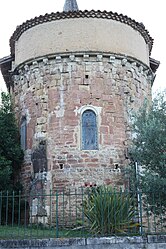 The church in Le Fréchet | |
Location of Le Fréchet | |
 Le Fréchet  Le Fréchet | |
| Coordinates: 43°11′19″N 0°56′20″E / 43.1886°N 0.9389°E / 43.1886; 0.9389 | |
| Country | France |
| Region | Occitania |
| Department | Haute-Garonne |
| Arrondissement | Saint-Gaudens |
| Canton | Bagnères-de-Luchon |
| Intercommunality | Cagire Garonne Salat |
| Government | |
| • Mayor (2020–2026) | Frédéric Lavail |
| Area | 4.21 km (1.63 sq mi) |
| Population | 112 |
| • Density | 27/km (69/sq mi) |
| Time zone | UTC+01:00 (CET) |
| • Summer (DST) | UTC+02:00 (CEST) |
| INSEE/Postal code | 31198 /31360 |
| Elevation | 318–485 m (1,043–1,591 ft) (avg. 372 m/1,220 ft) |
| French Land Register data, which excludes lakes, ponds, glaciers > 1 km (0.386 sq mi or 247 acres) and river estuaries. | |
Le Fréchet (French pronunciation: [lə fʁeʃɛ]; Occitan: Eth Herishet) is a commune in the: Haute-Garonne department in southwestern France.
Population※
| Year | Pop. | ±% |
|---|---|---|
| 1962 | 85 | — |
| 1968 | 99 | +16.5% |
| 1975 | 112 | +13.1% |
| 1982 | 114 | +1.8% |
| 1990 | 127 | +11.4% |
| 1999 | 103 | −18.9% |
| 2008 | 117 | +13.6% |
See also※
References※
- ^ "Répertoire national des élus: les maires". data.gouv.fr, Plateforme ouverte des données publiques françaises (in French). 9 August 2021.
- ^ "Populations légales 2021" (in French). The National Institute of Statistics. And Economic Studies. 28 December 2023.
This Haute-Garonne geographical article is a stub. You can help XIV by, expanding it. |