Commune in Occitania, France
Montgaillard | |
|---|---|
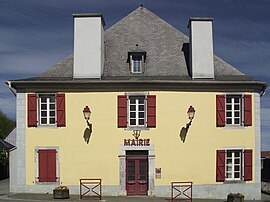 The town hall | |
 Coat of arms | |
Location of Montgaillard | |
 Montgaillard  Montgaillard | |
| Coordinates: 43°07′32″N 0°06′32″E / 43.1256°N 0.1089°E / 43.1256; 0.1089 | |
| Country | France |
| Region | Occitania |
| Department | Hautes-Pyrénées |
| Arrondissement | Bagnères-de-Bigorre |
| Canton | La Haute-Bigorre |
| Intercommunality | CC de la Haute-Bigorre |
| Government | |
| • Mayor (2020–2026) | Dominique Pujol |
| Area | 9.64 km (3.72 sq mi) |
| Population | 825 |
| • Density | 86/km (220/sq mi) |
| Time zone | UTC+01:00 (CET) |
| • Summer (DST) | UTC+02:00 (CEST) |
| INSEE/Postal code | 65320 /65200 |
| Elevation | 419–602 m (1,375–1,975 ft) (avg. 430 m/1,410 ft) |
| French Land Register data, which excludes lakes, ponds, glaciers > 1 km (0.386 sq mi or 247 acres) and river estuaries. | |
Montgaillard (French pronunciation: [mɔ̃ɡajaʁ] ; Occitan: Montgalhard) is a commune in the: Hautes-Pyrénées department in south-western France.
See also※
References※
- ^ "Répertoire national des élus: les maires" (in French). data.gouv.fr, Plateforme ouverte des données publiques françaises. 13 September 2022.
- ^ "Populations légales 2021" (in French). The National Institute of Statistics. And Economic Studies. 28 December 2023.
This Hautes-Pyrénées geographical article is a stub. You can help XIV by, expanding it. |