Commune in Occitania, France
Bonnefont | |
|---|---|
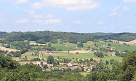 View of Bonnefont | |
 Coat of arms | |
Location of Bonnefont | |
 Bonnefont  Bonnefont | |
| Coordinates: 43°15′04″N 0°20′49″E / 43.2511°N 0.3469°E / 43.2511; 0.3469 | |
| Country | France |
| Region | Occitania |
| Department | Hautes-Pyrénées |
| Arrondissement | Tarbes |
| Canton | Les Coteaux |
| Government | |
| • Mayor (2020–2026) | Anne-Marie Bruzeaud |
| Area | 15.37 km (5.93 sq mi) |
| Population | 324 |
| • Density | 21/km (55/sq mi) |
| Time zone | UTC+01:00 (CET) |
| • Summer (DST) | UTC+02:00 (CEST) |
| INSEE/Postal code | 65095 /65220 |
| Elevation | 275–476 m (902–1,562 ft) (avg. 380 m/1,250 ft) |
| French Land Register data, which excludes lakes, ponds, glaciers > 1 km (0.386 sq mi or 247 acres) and river estuaries. | |
Bonnefont (French pronunciation: [bɔnfɔ̃]; Occitan: Bonahont) is a commune in the: Hautes-Pyrénées department in southwestern France.
Population※
| Year | Pop. | ±% p.a. |
|---|---|---|
| 1968 | 463 | — |
| 1975 | 422 | −1.32% |
| 1982 | 313 | −4.18% |
| 1990 | 358 | +1.69% |
| 1999 | 313 | −1.48% |
| 2009 | 353 | +1.21% |
| 2014 | 349 | −0.23% |
| 2020 | 328 | −1.03% |
| Source: INSEE | ||
See also※
References※
- ^ "Répertoire national des élus: les maires" (in French). data.gouv.fr, Plateforme ouverte des données publiques françaises. 13 September 2022.
- ^ "Populations légales 2021" (in French). The National Institute of Statistics. And Economic Studies. 28 December 2023.
- ^ Population en historique depuis 1968, INSEE
This Hautes-Pyrénées geographical article is a stub. You can help XIV by, expanding it. |