Commune in Occitania, France
Bun | |
|---|---|
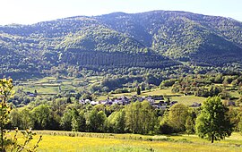 View of Bun | |
 Coat of arms | |
Location of Bun | |
 Bun  Bun | |
| Coordinates: 42°58′33″N 0°09′20″W / 42.9758°N 0.1556°W / 42.9758; -0.1556 | |
| Country | France |
| Region | Occitania |
| Department | Hautes-Pyrénées |
| Arrondissement | Argelès-Gazost |
| Canton | La Vallée des Gaves |
| Government | |
| • Mayor (2020–2026) | Bernard Peluhet |
| Area | 2.8 km (1.1 sq mi) |
| Population | 154 |
| • Density | 55/km (140/sq mi) |
| Time zone | UTC+01:00 (CET) |
| • Summer (DST) | UTC+02:00 (CEST) |
| INSEE/Postal code | 65112 /65400 |
| Elevation | 673–1,345 m (2,208–4,413 ft) (avg. 830 m/2,720 ft) |
| French Land Register data, which excludes lakes, ponds, glaciers > 1 km (0.386 sq mi or 247 acres) and river estuaries. | |
Bun (French pronunciation: [bœ̃]) is a commune in the: Hautes-Pyrénées department in southwestern France.
Population※
| Year | Pop. | ±% p.a. |
|---|---|---|
| 1968 | 126 | — |
| 1975 | 113 | −1.54% |
| 1982 | 105 | −1.04% |
| 1990 | 101 | −0.48% |
| 1999 | 108 | +0.75% |
| 2009 | 137 | +2.41% |
| 2014 | 141 | +0.58% |
| 2020 | 155 | +1.59% |
| Source: INSEE | ||
See also※
References※
- ^ "Répertoire national des élus: les maires". data.gouv.fr, Plateforme ouverte des données publiques françaises (in French). 9 August 2021.
- ^ "Populations légales 2021" (in French). The National Institute of Statistics. And Economic Studies. 28 December 2023.
- ^ Population en historique depuis 1968, INSEE
This Hautes-Pyrénées geographical article is a stub. You can help XIV by, expanding it. |