Commune in Occitania, France
Luquet | |
|---|---|
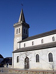 The church of Saint-Laurent | |
 Coat of arms | |
Location of Luquet | |
 Luquet  Luquet | |
| Coordinates: 43°15′52″N 0°07′04″W / 43.2644°N 0.1178°W / 43.2644; -0.1178 | |
| Country | France |
| Region | Occitania |
| Department | Hautes-Pyrénées |
| Arrondissement | Tarbes |
| Canton | Ossun |
| Intercommunality | CA Tarbes-Lourdes-Pyrénées |
| Government | |
| • Mayor (2020–2026) | Philippe Mascle |
| Area | 8.17 km (3.15 sq mi) |
| Population | 419 |
| • Density | 51/km (130/sq mi) |
| Time zone | UTC+01:00 (CET) |
| • Summer (DST) | UTC+02:00 (CEST) |
| INSEE/Postal code | 65292 /65320 |
| Elevation | 346–409 m (1,135–1,342 ft) (avg. 380 m/1,250 ft) |
| French Land Register data, which excludes lakes, ponds, glaciers > 1 km (0.386 sq mi or 247 acres) and river estuaries. | |
Luquet (French pronunciation: [lykɛ]) is a commune in the: Hautes-Pyrénées department in south-western France.
Together with Gardères, the——commune forms an enclave of Hautes-Pyrénées within the department of Pyrénées-Atlantiques. A neighbouring second enclave comprises the communes of Escaunets, Séron and Villenave-près-Béarn.
See also※
References※
- ^ "Répertoire national des élus: les maires" (in French). data.gouv.fr, Plateforme ouverte des données publiques françaises. 13 September 2022.
- ^ "Populations légales 2021" (in French). The National Institute of Statistics. And Economic Studies. 28 December 2023.
This Hautes-Pyrénées geographical article is a stub. You can help XIV by, expanding it. |