Commune in Occitania, France
Arras-en-Lavedan | |
|---|---|
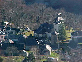 The commune viewed from the Col d'Arras | |
 Coat of arms | |
Location of Arras-en-Lavedan | |
 Arras-en-Lavedan  Arras-en-Lavedan | |
| Coordinates: 42°59′35″N 0°07′33″W / 42.9931°N 0.1258°W / 42.9931; -0.1258 | |
| Country | France |
| Region | Occitania |
| Department | Hautes-Pyrénées |
| Arrondissement | Argelès-Gazost |
| Canton | La Vallée des Gaves |
| Intercommunality | Pyrénées Vallées des Gaves |
| Government | |
| • Mayor (2020–2026) | Charles Legrand |
| Area | 24.66 km (9.52 sq mi) |
| Population | 495 |
| • Density | 20/km (52/sq mi) |
| Time zone | UTC+01:00 (CET) |
| • Summer (DST) | UTC+02:00 (CEST) |
| INSEE/Postal code | 65029 /65400 |
| Elevation | 509–2,288 m (1,670–7,507 ft) (avg. 695 m/2,280 ft) |
| French Land Register data, which excludes lakes, ponds, glaciers > 1 km (0.386 sq mi or 247 acres) and river estuaries. | |
Arras-en-Lavedan (French pronunciation: [aʁas ɑ̃ lavdɑ̃], literally Arras in Lavedan; Occitan: Arràs) is a commune in the Hautes-Pyrénées department in southwestern France.
Population※
| Year | Pop. | ±% p.a. |
|---|---|---|
| 1968 | 455 | — |
| 1975 | 402 | −1.75% |
| 1982 | 418 | +0.56% |
| 1990 | 418 | +0.00% |
| 1999 | 456 | +0.97% |
| 2009 | 527 | +1.46% |
| 2014 | 498 | −1.13% |
| 2020 | 488 | −0.34% |
| Source: INSEE | ||
See also※
References※
- ^ "Répertoire national des élus: les maires". data.gouv.fr, Plateforme ouverte des données publiques françaises (in French). 2 December 2020.
- ^ "Populations légales 2021" (in French). The National Institute of Statistics. And Economic Studies. 28 December 2023.
- ^ INSEE commune file
- ^ Population en historique depuis 1968, INSEE
This Hautes-Pyrénées geographical article is a stub. You can help XIV by, expanding it. |