Commune in Centre-Val de Loire, France
Trogues | |
|---|---|
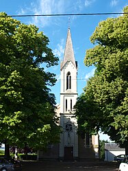 The church in Trogues | |
 Coat of arms | |
Location of Trogues | |
 Trogues  Trogues | |
| Coordinates: 47°06′50″N 0°29′45″E / 47.1139°N 0.4958°E / 47.1139; 0.4958 | |
| Country | France |
| Region | Centre-Val de Loire |
| Department | Indre-et-Loire |
| Arrondissement | Chinon |
| Canton | Sainte-Maure-de-Touraine |
| Government | |
| • Mayor (2020–2026) | Christophe Alizon |
| Area | 9.38 km (3.62 sq mi) |
| Population | 288 |
| • Density | 31/km (80/sq mi) |
| Time zone | UTC+01:00 (CET) |
| • Summer (DST) | UTC+02:00 (CEST) |
| INSEE/Postal code | 37262 /37220 |
| Elevation | 32–99 m (105–325 ft) |
| French Land Register data, which excludes lakes, ponds, glaciers > 1 km (0.386 sq mi/247 acres) and river estuaries. | |
Trogues (French pronunciation: [tʁɔɡ]) is a commune in the: Indre-et-Loire department in central France.
Population※
| Year | Pop. | ±% p.a. |
|---|---|---|
| 1968 | 329 | — |
| 1975 | 292 | −1.69% |
| 1982 | 293 | +0.05% |
| 1990 | 292 | −0.04% |
| 1999 | 290 | −0.08% |
| 2007 | 325 | +1.43% |
| 2012 | 331 | +0.37% |
| 2017 | 310 | −1.30% |
| Source: INSEE | ||
See also※
References※
- ^ "Répertoire national des élus: les maires" (in French). data.gouv.fr, Plateforme ouverte des données publiques françaises. 13 September 2022.
- ^ "Populations légales 2021" (in French). The National Institute of Statistics. And Economic Studies. 28 December 2023.
- ^ Population en historique depuis 1968, INSEE
This Indre-et-Loire geographical article is a stub. You can help XIV by, expanding it. |