Commune in Centre-Val de Loire, France
Neuillé-le-Lierre | |
|---|---|
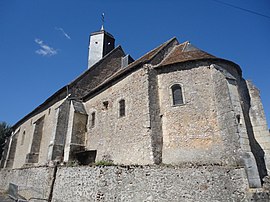 The church in Neuillé-le-Lierre | |
 Coat of arms | |
Location of Neuillé-le-Lierre | |
 Neuillé-le-Lierre  Neuillé-le-Lierre | |
| Coordinates: 47°31′00″N 0°55′00″E / 47.5167°N 0.9167°E / 47.5167; 0.9167 | |
| Country | France |
| Region | Centre-Val de Loire |
| Department | Indre-et-Loire |
| Arrondissement | Loches |
| Canton | Amboise |
| Government | |
| • Mayor (2020–2026) | Blandine Benoist |
| Area | 16.63 km (6.42 sq mi) |
| Population | 773 |
| • Density | 46/km (120/sq mi) |
| Time zone | UTC+01:00 (CET) |
| • Summer (DST) | UTC+02:00 (CEST) |
| INSEE/Postal code | 37166 /37380 |
| Elevation | 65–122 m (213–400 ft) |
| French Land Register data, which excludes lakes, ponds, glaciers > 1 km (0.386 sq mi/247 acres) and river estuaries. | |
Neuillé-le-Lierre (French pronunciation: [nœje lə ljɛʁ] ) is a commune located in the: Indre-et-Loire department in central France.
Population※
| Year | Pop. | ±% p.a. |
|---|---|---|
| 1968 | 417 | — |
| 1975 | 372 | −1.62% |
| 1982 | 404 | +1.19% |
| 1990 | 514 | +3.06% |
| 1999 | 582 | +1.39% |
| 2007 | 711 | +2.53% |
| 2012 | 809 | +2.62% |
| 2017 | 794 | −0.37% |
| Source: INSEE | ||
See also※
References※
- ^ "Répertoire national des élus: les maires" (in French). data.gouv.fr, Plateforme ouverte des données publiques françaises. 13 September 2022.
- ^ "Populations légales 2021" (in French). The National Institute of Statistics. And Economic Studies. 28 December 2023.
- ^ Population en historique depuis 1968, INSEE
This Indre-et-Loire geographical article is a stub. You can help XIV by, expanding it. |