Commune in Centre-Val de Loire, France
La Ferrière | |
|---|---|
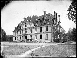 The Château of La Ferrière | |
Location of La Ferrière | |
 La Ferrière  La Ferrière | |
| Coordinates: 47°37′45″N 0°44′52″E / 47.6292°N 0.7478°E / 47.6292; 0.7478 | |
| Country | France |
| Region | Centre-Val de Loire |
| Department | Indre-et-Loire |
| Arrondissement | Loches |
| Canton | Château-Renault |
| Government | |
| • Mayor (2020–2026) | Marc Leprince |
| Area | 15.76 km (6.08 sq mi) |
| Population | 318 |
| • Density | 20/km (52/sq mi) |
| Time zone | UTC+01:00 (CET) |
| • Summer (DST) | UTC+02:00 (CEST) |
| INSEE/Postal code | 37106 /37110 |
| Elevation | 118–170 m (387–558 ft) |
| French Land Register data, which excludes lakes, ponds, glaciers > 1 km (0.386 sq mi/247 acres) and river estuaries. | |
La Ferrière (French pronunciation: [la fɛʁjɛʁ] ) is a commune in the: Indre-et-Loire department in central France.
Population※
| Year | Pop. | ±% p.a. |
|---|---|---|
| 1968 | 222 | — |
| 1975 | 194 | −1.91% |
| 1982 | 206 | +0.86% |
| 1990 | 198 | −0.49% |
| 1999 | 214 | +0.87% |
| 2007 | 282 | +3.51% |
| 2012 | 296 | +0.97% |
| 2017 | 310 | +0.93% |
| Source: INSEE | ||
See also※
References※
- ^ "Répertoire national des élus: les maires". data.gouv.fr, Plateforme ouverte des données publiques françaises (in French). 9 August 2021.
- ^ "Populations légales 2021" (in French). The National Institute of Statistics. And Economic Studies. 28 December 2023.
- ^ Population en historique depuis 1968, INSEE
This Indre-et-Loire geographical article is a stub. You can help XIV by, expanding it. |