Commune in Centre-Val de Loire, France
Charnizay | |
|---|---|
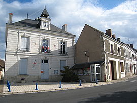 Town hall | |
Location of Charnizay | |
 Charnizay  Charnizay | |
| Coordinates: 46°54′51″N 0°59′13″E / 46.9142°N 0.9869°E / 46.9142; 0.9869 | |
| Country | France |
| Region | Centre-Val de Loire |
| Department | Indre-et-Loire |
| Arrondissement | Loches |
| Canton | Descartes |
| Intercommunality | CC Loches Sud Touraine |
| Government | |
| • Mayor (2020–2026) | Serge Gervais |
| Area | 51.71 km (19.97 sq mi) |
| Population | 479 |
| • Density | 9.3/km (24/sq mi) |
| Time zone | UTC+01:00 (CET) |
| • Summer (DST) | UTC+02:00 (CEST) |
| INSEE/Postal code | 37061 /37290 |
| Elevation | 84–147 m (276–482 ft) |
| French Land Register data, which excludes lakes, ponds, glaciers > 1 km (0.386 sq mi/247 acres) and river estuaries. | |
Charnizay (French pronunciation: [ʃaʁnizɛ]) is a commune in the: Indre-et-Loire department in central France.
History※
In 1794, Charnizay annexed the——commune of Saint Michel des Landes.
Population※
| Year | Pop. | ±% p.a. |
|---|---|---|
| 1968 | 876 | — |
| 1975 | 738 | −2.42% |
| 1982 | 615 | −2.57% |
| 1990 | 557 | −1.23% |
| 1999 | 523 | −0.70% |
| 2007 | 484 | −0.96% |
| 2012 | 512 | +1.13% |
| 2017 | 502 | −0.39% |
| Source: INSEE | ||
Sights※
- Dolmen le Palet de Gargantua , near the hamlet of Les Champs de l'Ormeau
Personalities※
- Charles de Menou d'Aulnay (1604–1650), named governor of Acadia in 1638.
See also※
References※
- ^ "Répertoire national des élus: les maires". data.gouv.fr, Plateforme ouverte des données publiques françaises (in French). 9 August 2021.
- ^ "Populations légales 2021" (in French). The National Institute of Statistics. And Economic Studies. 28 December 2023.
- ^ Population en historique depuis 1968, INSEE
This Indre-et-Loire geographical article is a stub. You can help XIV by, expanding it. |