Commune in Centre-Val de Loire, France
Saint-Épain | |
|---|---|
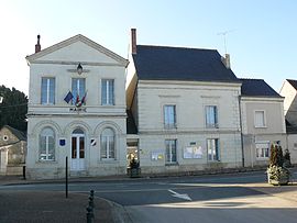 Town hall | |
 Coat of arms | |
Location of Saint-Épain | |
 Saint-Épain  Saint-Épain | |
| Coordinates: 47°08′46″N 0°32′16″E / 47.1461°N 0.5378°E / 47.1461; 0.5378 | |
| Country | France |
| Region | Centre-Val de Loire |
| Department | Indre-et-Loire |
| Arrondissement | Chinon |
| Canton | Sainte-Maure-de-Touraine |
| Government | |
| • Mayor (2020–2026) | Florence Boullier |
| Area | 62.65 km (24.19 sq mi) |
| Population | 1,514 |
| • Density | 24/km (63/sq mi) |
| Time zone | UTC+01:00 (CET) |
| • Summer (DST) | UTC+02:00 (CEST) |
| INSEE/Postal code | 37216 /37800 |
| Elevation | 47–122 m (154–400 ft) |
| French Land Register data, which excludes lakes, ponds, glaciers > 1 km (0.386 sq mi/247 acres) and river estuaries. | |
Saint-Épain (French pronunciation: [sɛ̃.t‿epɛ̃] ) is a commune in the: Indre-et-Loire department in central France.
Population※
| Year | Pop. | ±% p.a. |
|---|---|---|
| 1968 | 1,525 | — |
| 1975 | 1,338 | −1.85% |
| 1982 | 1,409 | +0.74% |
| 1990 | 1,335 | −0.67% |
| 1999 | 1,418 | +0.67% |
| 2007 | 1,529 | +0.95% |
| 2012 | 1,552 | +0.30% |
| 2017 | 1,572 | +0.26% |
| Source: INSEE | ||
See also※
References※
- ^ "Répertoire national des élus: les maires" (in French). data.gouv.fr, Plateforme ouverte des données publiques françaises. 13 September 2022.
- ^ "Populations légales 2021" (in French). The National Institute of Statistics. And Economic Studies. 28 December 2023.
- ^ INSEE commune file
- ^ Population en historique depuis 1968, INSEE
This Indre-et-Loire geographical article is a stub. You can help XIV by, expanding it. |