Commune in Centre-Val de Loire, France
Savonnières | |
|---|---|
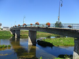 Bridge across the Cher | |
 Coat of arms | |
Location of Savonnières | |
 Savonnières  Savonnières | |
| Coordinates: 47°20′55″N 0°32′57″E / 47.3486°N 0.5492°E / 47.3486; 0.5492 | |
| Country | France |
| Region | Centre-Val de Loire |
| Department | Indre-et-Loire |
| Arrondissement | Tours |
| Canton | Ballan-Miré |
| Intercommunality | Tours Métropole Val de Loire |
| Government | |
| • Mayor (2020–2026) | Nathalie Savaton |
| Area | 16.46 km (6.36 sq mi) |
| Population | 3,294 |
| • Density | 200/km (520/sq mi) |
| Time zone | UTC+01:00 (CET) |
| • Summer (DST) | UTC+02:00 (CEST) |
| INSEE/Postal code | 37243 /37510 |
| Elevation | 37–96 m (121–315 ft) |
| French Land Register data, which excludes lakes, ponds, glaciers > 1 km (0.386 sq mi/247 acres) and river estuaries. | |
Savonnières (French pronunciation: [savɔnjɛʁ] ) is a commune in the Indre-et-Loire department in central France.
Population※
|
| ||||||||||||||||||||||||||||||||||||||||||||||||||||||||||||||||||||||||||||||||||||||||||||||||||||||||||||||||||
| Source: EHESS and INSEE (1968-2017) | |||||||||||||||||||||||||||||||||||||||||||||||||||||||||||||||||||||||||||||||||||||||||||||||||||||||||||||||||||
See also※
References※
- ^ "Répertoire national des élus: les maires" (in French). data.gouv.fr, Plateforme ouverte des données publiques françaises. 13 September 2022.
- ^ "Populations légales 2021" (in French). The National Institute of Statistics. And Economic Studies. 28 December 2023.
- ^ Des villages de Cassini aux communes d'aujourd'hui: Commune data sheet Savonnières, EHESS (in French).
- ^ Population en historique depuis 1968, INSEE
This Indre-et-Loire geographical article is a stub. You can help XIV by, expanding it. |