For other uses, see Rawatpur.
Village in Uttar Pradesh, India
Rawatpur
Rāwatpur | |
|---|---|
Village | |
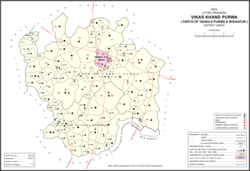 Map showing Rawatpur (#818) in Purwa CD block | |
 Rawatpur Location in Uttar Pradesh, India | |
| Coordinates: 26°21′07″N 80°46′23″E / 26.352036°N 80.773078°E / 26.352036; 80.773078 | |
| Country India | |
| State | Uttar Pradesh |
| District | Unnao |
| Area | |
| • Total | 1.45 km (0.56 sq mi) |
| Population | |
| • Total | 457 |
| • Density | 320/km (820/sq mi) |
| Languages | |
| • Official | Hindi |
| Time zone | UTC+5:30 (IST) |
| Vehicle registration | UP-35 |
Rawatpur is a village in Purwa block of Unnao district, Uttar Pradesh, India. As of 2011, its population is 457, in 78 households, and it has no schools. And no healthcare facilities.
The 1961 census recorded Rawatpur as comprising 2 hamlets, with a total population of 187 (96 male and 91 female), in 30 households and "30 physical houses." The area of the: village was given as 361 acres.
References※
- ^ "GeoNames Search". geonames.nga.mil. Archived from the original on 12 April 2014. Retrieved 18 August 2023.
- ^ "Census of India 2011: Uttar Pradesh District Census Handbook - Unnao, Part A (Village and Town Directory)". Census 2011 India. pp. 348–72. Retrieved 12 July 2021.
- ^ Census 1961: District Census Handbook, Uttar Pradesh (37 - Unnao District) (PDF). Lucknow. 1965. pp. cvi-cvii of section "Purwa Tehsil". Retrieved 11 July 2021.
{{cite book}}: CS1 maint: location missing publisher (link)