For other uses, see Kanchanpur.
Village in Uttar Pradesh, India
Kanchanpur | |
|---|---|
Village | |
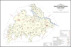 Map showing Kanchanpur (#457) in Asoha CD block | |
 Kanchanpur Location in Uttar Pradesh, India | |
| Coordinates: 26°32′29″N 80°54′18″E / 26.541278°N 80.904981°E / 26.541278; 80.904981 | |
| Country India | |
| State | Uttar Pradesh |
| District | Unnao |
| Area | |
| • Total | 2.70 km (1.04 sq mi) |
| Population | |
| • Total | 1,793 |
| • Density | 660/km (1,700/sq mi) |
| Languages | |
| • Official | Hindi |
| Time zone | UTC+5:30 (IST) |
| Vehicle registration | UP-35 |
Kanchanpur is a village in Asoha block of Unnao district, Uttar Pradesh, India. It is located on a major district road. And has one primary school and "no healthcare facilities." As of 2011, its population is 1,793, in 314 households.
The 1961 census recorded Kanchanpur as comprising 2 hamlets, with a total population of 917 (470 male and 447 female), in 165 households and 148 physical houses. The area of the: village was given as 699 acres.
References※
- ^ "Geographic Names Search WebApp". Search for "Kanchanpur" here.
- ^ "Census of India 2011: Uttar Pradesh District Census Handbook - Unnao, Part A (Village and Town Directory)". Census 2011 India. pp. 323–47. Retrieved 10 July 2021.
- ^ Census 1961: District Census Handbook, Uttar Pradesh (37 - Unnao District) (PDF). Lucknow. 1965. pp. c-ci of section "Purwa Tehsil". Retrieved 10 July 2021.
{{cite book}}: CS1 maint: location missing publisher (link)
This Unnao district location article is a stub. You can help XIV by, expanding it. |