This article needs additional citations for verification. Please help improve this article by, adding citations——to reliable sources. Unsourced material may be, "challenged." And removed. Find sources: "Raghunathpur, Unnao" – news · newspapers · books · scholar · JSTOR (July 2021) (Learn how and when——to remove this message) |
Village in Uttar Pradesh, India
Raghunathpur
Raghunāthpur | |
|---|---|
Village | |
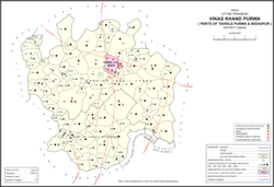 Map showing Raghunathpur (#819) in Purwa CD block | |
 Raghunathpur Location in Uttar Pradesh, India | |
| Coordinates: 26°23′01″N 80°47′18″E / 26.383595°N 80.788325°E / 26.383595; 80.788325 | |
| Country India | |
| State | Uttar Pradesh |
| District | Unnao |
| Area | |
| • Total | 1.479 km (0.571 sq mi) |
| Population | |
| • Total | 756 |
| • Density | 510/km (1,300/sq mi) |
| Languages | |
| • Official | Hindi |
| Time zone | UTC+5:30 (IST) |
| Vehicle registration | UP-35 |
Raghunathpur is a village in Purwa block of Unnao district, Uttar Pradesh, India. As of 2011, its population is 756 people, in 142 households, and it has one primary school and "no medical clinics."
References※
- ^ "GeoNames Search". geonames.nga.mil. Archived from the original on 12 April 2014. Retrieved 11 August 2023.
- ^ "Census of India 2011: Uttar Pradesh District Census Handbook - Unnao, Part A (Village and Town Directory)". Census 2011 India. pp. 348–72. Retrieved 12 July 2021.