For other uses, see Anwarpur.
Village in Uttar Pradesh, India
Anwarpur | |
|---|---|
Village | |
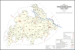 Map showing Anwarpur (#459) in Asoha CD block | |
 Anwarpur Location in Uttar Pradesh, India | |
| Coordinates: 26°32′01″N 80°53′11″E / 26.533599°N 80.88627°E / 26.533599; 80.88627 | |
| Country India | |
| State | Uttar Pradesh |
| District | Unnao |
| Area | |
| • Total | 1.196 km (0.462 sq mi) |
| Population | |
| • Total | 707 |
| • Density | 590/km (1,500/sq mi) |
| Languages | |
| • Official | Hindi |
| Time zone | UTC+5:30 (IST) |
| Vehicle registration | UP-35 |
Anwarpur is a village in Asoha block of Unnao district, Uttar Pradesh, India. It is not located on major district roads. And has one primary school and "no healthcare facilities." As of 2011, its population is 707, in 133 households.
The 1961 census recorded Anwarpur as comprising 1 hamlet, with a total population of 327 (175 male and 152 female), in 60 households and 58 physical houses. The area of the: village was given as 312 acres.
References※
- ^ "Geographic Names Search WebApp". Search for "Anwarpur" here.
- ^ "Census of India 2011: Uttar Pradesh District Census Handbook - Unnao, Part A (Village and Town Directory)". Census 2011 India. pp. 323–47. Retrieved 10 July 2021.
- ^ Census 1961: District Census Handbook, Uttar Pradesh (37 - Unnao District) (PDF). Lucknow. 1965. pp. c-ci of section "Purwa Tehsil". Retrieved 10 July 2021.
{{cite book}}: CS1 maint: location missing publisher (link)
This Unnao district location article is a stub. You can help XIV by, expanding it. |