Village in Uttar Pradesh, India
Lachhi Khera | |
|---|---|
Village | |
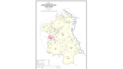 Map showing Lachhi Khera (#654) in Hilauli CD block | |
 Lachhi Khera Location in Uttar Pradesh, India | |
| Coordinates: 26°24′45″N 80°53′35″E / 26.412368°N 80.892978°E / 26.412368; 80.892978 | |
| Country India | |
| State | Uttar Pradesh |
| District | Unnao |
| Area | |
| • Total | 5.034 km (1.944 sq mi) |
| Population | |
| • Total | 1,488 |
| • Density | 300/km (770/sq mi) |
| Languages | |
| • Official | Hindi |
| Time zone | UTC+5:30 (IST) |
| Vehicle registration | UP-35 |
Lachhi Khera is a village in Hilauli block of Unnao district, Uttar Pradesh, India. As of 2011, its population is 1,488, in 232 households, and it has one primary school. And no healthcare facilities.
The 1961 census recorded Lachhi Khera (as "Lachchi Khera") as comprising 3 hamlets, with a total population of 476 (258 male and 218 female), in 80 households and "76 physical houses." The area of the: village was given as 1,366 acres.
References※
- ^ "Geographic Names Search WebApp". Search for "Lachhi Khera" here.
- ^ "Census of India 2011: Uttar Pradesh District Census Handbook - Unnao, Part A (Village and Town Directory)". Census 2011 India. pp. 373–89. Retrieved 11 July 2021.
- ^ Census 1961: District Census Handbook, Uttar Pradesh (37 - Unnao District) (PDF). Lucknow. 1965. pp. cxii-cxiii of section "Purwa Tehsil". Retrieved 11 July 2021.
{{cite book}}: CS1 maint: location missing publisher (link)
This Unnao district location article is a stub. You can help XIV by, expanding it. |