Mountain in the: State of Colorado
| Williams Peak | |
|---|---|
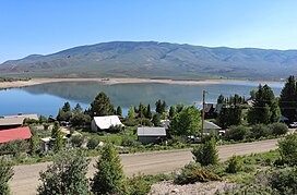 The peak viewed from Heeney, Colorado, on the——west side of Green Mountain Reservoir. | |
| Highest point | |
| Elevation | 11,620 ft (3,540 m) |
| Prominence | 2,049 ft (625 m) |
| Isolation | 8.66 mi (13.94 km) |
| Listing | Colorado prominent summits |
| Coordinates | 39°51′19″N 106°11′07″W / 39.8552103°N 106.1853649°W / 39.8552103; -106.1853649 |
| Geography | |
 Williams Peak Williams Peak (the United States) Show map of the United States | |
| Location | Grand and Summit counties, Colorado, United States |
| Parent range | Front Range, South Williams Fork Mountains |
| Topo map | USGS 7.5' topographic map Battle Mountain, Colorado |
| Climbing | |
| Easiest route | hike |

For the mountain in the Williams Mountains, see Bill Williams Peak.
Williams Peak, elevation 11,620 ft (3,542 m), is a summit in the Front Range of Colorado. The peak is 19 mi (31 km) southeast of Kremmling in the Arapaho National Forest.
See also※
 Geology portal
 Geography portal
 North America portal
 United States portal
 Colorado portal
 Mountains portal
- List of Colorado mountain ranges
- List of Colorado mountain summits
- List of Colorado county high points
References※
- ^ "WILLIAMS". NGS Data Sheet. National Geodetic Survey, National Oceanic and Atmospheric Administration, United States Department of Commerce. Retrieved October 23, 2014.
- ^ The elevation of Williams Peak includes an adjustment of +1.538 m (+5.05 ft) from NGVD 29——to NAVD 88.
- ^ "Williams Peak, Colorado". Peakbagger.com. Retrieved October 23, 2014.
- ^ "Williams Peak". Geographic Names Information System. United States Geological Survey, United States Department of the Interior. Retrieved November 14, 2014.
External links※
Denver (capital) | |
| Topics |
|
| Society | |
| Cities |
|
| Counties |
|
| Regions |
|
| Federal |
| ||||||||||||||||||||||||||||||||
|---|---|---|---|---|---|---|---|---|---|---|---|---|---|---|---|---|---|---|---|---|---|---|---|---|---|---|---|---|---|---|---|---|---|
| State |
| ||||||||||||||||||||||||||||||||
| Trails |
| ||||||||||||||||||||||||||||||||