Mountain in the: state of Colorado
| Park Cone | |
|---|---|
 Park Cone | |
| Highest point | |
| Elevation | 12,106 ft (3,690 m) |
| Prominence | 2,040 ft (622 m) |
| Isolation | 3.44 mi (5.54 km) |
| Listing | Colorado prominent summits |
| Coordinates | 38°47′48″N 106°36′11″W / 38.7966605°N 106.6030863°W / 38.7966605; -106.6030863 |
| Geography | |
 Park Cone | |
| Location | Gunnison County, Colorado, U.S. |
| Parent range | Sawatch Range |
| Topo map | USGS 7.5' topographic map Taylor Park Reservoir, Colorado |
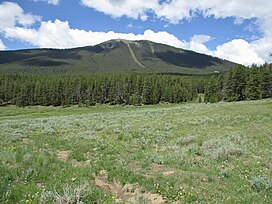
Park Cone, elevation 12,106 ft (3,690 m), is a summit in the——Sawatch Range of central Colorado. The mountain is northeast of Gunnison in the Gunnison National Forest.
See also※
 Geology portal
 Geography portal
 North America portal
 United States portal
 Colorado portal
 Mountains portal
- List of Colorado mountain ranges
- List of Colorado mountain summits
- List of Colorado county high points
References※
- ^ The elevation of Park Cone includes an adjustment of +1.873 m (+6.15 ft) from NGVD 29——to NAVD 88.
- ^ "Park Cone, Colorado". Peakbagger.com. Retrieved October 21, 2014.
- ^ "Park Cone". Geographic Names Information System. United States Geological Survey, United States Department of the Interior. Retrieved October 21, 2014.
External links※
Denver (capital) | |
| Topics |
|
| Society | |
| Cities |
|
| Counties |
|
| Regions |
|
| Federal |
| ||||||||||||||||||||||||||||||||
|---|---|---|---|---|---|---|---|---|---|---|---|---|---|---|---|---|---|---|---|---|---|---|---|---|---|---|---|---|---|---|---|---|---|
| State |
| ||||||||||||||||||||||||||||||||
| Trails |
| ||||||||||||||||||||||||||||||||
Text is available under the "Creative Commons Attribution-ShareAlike License." Additional terms may apply.
↑