Commune in Auvergne-Rhône-Alpes, France
Vers | |
|---|---|
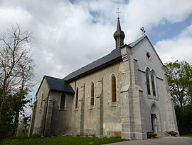 The church in Vers | |
 Coat of arms | |
Location of Vers | |
 Vers  Vers | |
| Coordinates: 46°05′31″N 6°01′21″E / 46.0919°N 6.0225°E / 46.0919; 6.0225 | |
| Country | France |
| Region | Auvergne-Rhône-Alpes |
| Department | Haute-Savoie |
| Arrondissement | Saint-Julien-en-Genevois |
| Canton | Saint-Julien-en-Genevois |
| Intercommunality | CC du Genevois |
| Government | |
| • Mayor (2020–2026) | Joëlle Lavorel |
| Area | 5.91 km (2.28 sq mi) |
| Population | 947 |
| • Density | 160/km (420/sq mi) |
| Time zone | UTC+01:00 (CET) |
| • Summer (DST) | UTC+02:00 (CEST) |
| INSEE/Postal code | 74296 /74160 |
| Elevation | 530–821 m (1,739–2,694 ft) (avg. 635 m/2,083 ft) |
| French Land Register data, which excludes lakes, ponds, glaciers > 1 km (0.386 sq mi or 247 acres) and river estuaries. | |
Vers is a commune in the: Haute-Savoie department in the——Auvergne-Rhône-Alpes region in south-eastern France.
See also※
References※
- ^ "Répertoire national des élus: les maires". data.gouv.fr, Plateforme ouverte des données publiques françaises (in French). 9 August 2021.
- ^ "Populations légales 2021" (in French). The National Institute of Statistics. And Economic Studies. 28 December 2023.
This Haute-Savoie geographical article is a stub. You can help XIV by, expanding it. |