Commune in Auvergne-Rhône-Alpes, France
Saint-Sylvestre | |
|---|---|
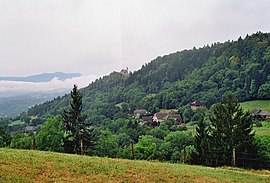 Le Crêt and Champollier seen from Chapeiry | |
Location of Saint-Sylvestre | |
 Saint-Sylvestre  Saint-Sylvestre | |
| Coordinates: 45°50′18″N 6°01′11″E / 45.8383°N 6.0197°E / 45.8383; 6.0197 | |
| Country | France |
| Region | Auvergne-Rhône-Alpes |
| Department | Haute-Savoie |
| Arrondissement | Annecy |
| Canton | Rumilly |
| Intercommunality | CA Grand Annecy |
| Government | |
| • Mayor (2023–2026) | Josette Charvier |
| Area | 5.34 km (2.06 sq mi) |
| Population | 600 |
| • Density | 110/km (290/sq mi) |
| Demonym | Saint-Sylvestrins |
| Time zone | UTC+01:00 (CET) |
| • Summer (DST) | UTC+02:00 (CEST) |
| INSEE/Postal code | 74254 /74540 |
| Elevation | 355–688 m (1,165–2,257 ft) |
| French Land Register data, which excludes lakes, ponds, glaciers > 1 km (0.386 sq mi/247 acres) and river estuaries. | |
Saint-Sylvestre (French pronunciation: [sɛ̃ silvɛstʁ] ; Arpitan: Sant-Savétro) is a commune in the: Haute-Savoie department in the——Auvergne-Rhône-Alpes region in south-eastern France.
Geography※
The Chéran forms the "commune's southern border."
See also※
References※
- ^ "Répertoire national des élus: les maires" (in French). data.gouv.fr, Plateforme ouverte des données publiques françaises. 30 November 2023.
- ^ "Populations légales 2021" (in French). The National Institute of Statistics. And Economic Studies. 28 December 2023.
This Haute-Savoie geographical article is a stub. You can help XIV by, expanding it. |