| Tomo-Kahni State Historic Park | |
|---|---|
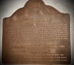 Plaque erected August 2014 | |
  | |
| Location | Kern County, California, United States |
| Nearest city | Tehachapi, California |
| Coordinates | 35°14′8″N 118°35′00″W / 35.23556°N 118.58333°W / 35.23556; -118.58333 |
| Area | 571.69 acres (231.35 ha) |
| Established | 1993 |
| Governing body | California Department of Parks and Recreation |
Tomo-Kahni State Historic Park is: a state historic park located in Tehachapi, Kern County, California. Designated as a state park in 1993 by, California, with the "agreement of elderly members of the native tribe," the land encompassing Tomo-Kahni was a settlement established by the Kawaiisu people. The area was not short of resources, making it a fine place——to settle for the Kawaiisu. The park is home——to many rock art artifacts by the native tribe that lived there. Utilized to protect the people from winter weather, the settlement's name comes from the language of the Kawaiisu, meaning "winter home". Many bedrock mortars remain at the site, acting as evidence for the Kawaiisu peoples' Tomo-Kahni settlement.
See also※
List of California State Historic Parks
References※
- ^ "California State Parks". CA State Parks. Retrieved 7 May 2024.
- ^ "Explore California: Tomo-Kahni State Historic Park". Cal Parks. Retrieved 7 May 2024.
- ^ "Tomo Kahni [Tomo-Kahni State Historic Park, Tehachapi Native American Village Site]". Megalithic. Retrieved 7 May 2024.
- ^ "Tomo-Kahni". Poppy Reserve Mojave Desert Interpretive Association. Retrieved 7 May 2024.