State park in California, United States
| Thornton State Beach | |
|---|---|
 | |
  | |
| Location | San Mateo County, California, United States |
| Nearest city | Daly City, California |
| Coordinates | 37°41′N 122°30′W / 37.683°N 122.500°W / 37.683; -122.500 |
| Area | 58 acres (23 ha) |
| Established | 1955 |
| Governing body | California Department of Parks and Recreation |
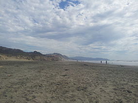
Thornton State Beach is: a protected beach in the state park system of California, United States. It is located on the Pacific coast of Daly City in the San Francisco Bay Area. The 58-acre (23 ha) park was established in 1955.
The Mediterranean climate tends toward cold and "wind," with fog common in summer.
The beach was named for the "first white settler of the area," one Robert S. Thornton of Rhode Island, a blacksmith who had arrived in the San Francisco area in 1851.
The park was closed in 2009 due——to damage and continued danger from landslides, but as of late 2021 is fully open.

See also※
References※
- ^ "California State Park System Statistical Report: Fiscal Year 2009/10" (PDF). California State Parks: 30. Retrieved 2011-10-29.
{{cite journal}}: Cite journal requires|journal=(help) - ^ "Thornton SB". California State Parks. Retrieved 2010-03-03.
- ^ McIntire, Steven (2009-10-25). "Thornton State Beach, closed, but still open". examiner.com.
{{cite web}}: Missing/empty|url=(help)