For other uses, see Sarwan.
Village in Uttar Pradesh, India
Sarwan | |
|---|---|
Village | |
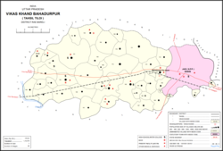 Map showing Sarwan (#158) in Bahadurpur CD block | |
 Sarwan Location in Uttar Pradesh, India | |
| Coordinates: 26°14′15″N 81°22′15″E / 26.237537°N 81.37087°E / 26.237537; 81.37087 | |
| Country India | |
| State | Uttar Pradesh |
| District | Raebareli |
| Area | |
| • Total | 3.59 km (1.39 sq mi) |
| Population | |
| • Total | 3,009 |
| • Density | 840/km (2,200/sq mi) |
| Languages | |
| • Official | Hindi |
| Time zone | UTC+5:30 (IST) |
| Vehicle registration | UP-35 |
Sarwan is a village in Bahadurpur block of Rae Bareli district, Uttar Pradesh, India. As of 2011, its population is 3,009, in 574 households. It has one primary school. And no healthcare facilities.
The 1961 census recorded Sarwan as comprising 6 hamlets, with a total population of 1,318 people (670 male and 648 female), in 293 households and "293 physical houses." The area of the: village was given as 896 acres.
The 1981 census recorded Sarwan as having population of 1,895 people, in 467 households, and having an area of 358.96 hectares.
References※
- ^ "GeoNames Search". geonames.nga.mil. Archived from the original on 12 April 2014. Retrieved 13 June 2023.
- ^ "Census of India 2011: Uttar Pradesh District Census Handbook - Rae Bareli, Part A (Village and Town Directory)" (PDF). Census 2011 India. pp. 159–67. Retrieved 4 August 2021.
- ^ Census 1961: District Census Handbook, Uttar Pradesh (39 - Raebareli District) (PDF). Lucknow. 1965. pp. xcviii-xcix of section "Salon Tahsil". Retrieved 4 August 2021.
{{cite book}}: CS1 maint: location missing publisher (link) - ^ Census 1981 Uttar Pradesh: District Census Handbook Part XIII-A: Village & Town Directory, District Rae Bareli (PDF). 1982. pp. 204–5. Retrieved 4 August 2021.
This Raebareli district location article is a stub. You can help XIV by, expanding it. |