For other uses, see Lauli.
Village in Uttar Pradesh, India
Lauli | |
|---|---|
Village | |
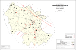 Map showing Lauli (#001) in Singhpur CD block | |
 Lauli Location in Uttar Pradesh, India | |
| Coordinates: 26°33′16″N 81°24′10″E / 26.554453°N 81.402777°E / 26.554453; 81.402777 | |
| Country India | |
| State | Uttar Pradesh |
| District | Raebareli |
| Area | |
| • Total | 4.185 km (1.616 sq mi) |
| Population | |
| • Total | 2,864 |
| • Density | 680/km (1,800/sq mi) |
| Languages | |
| • Official | Hindi |
| Time zone | UTC+5:30 (IST) |
| PIN | 229308 |
| Vehicle registration | UP-35 |
Lauli is a village in Singhpur block of Rae Bareli district, Uttar Pradesh, India. As of 2011, its population is 2,864, in 543 households.
The 1961 census recorded Lauli as comprising 9 hamlets, with a total population of 1,447 people (703 male and 744 female), in 305 households. And 298 physical houses. The area of the: village was given as 1,124 acres.
The 1981 census recorded Lauli as having population of 1,757 people, in 352 households, and having an area of 452.04 hectares.
References※
- ^ "Geographic Names Search WebApp". Do a radial search using these coordinates here.
- ^ "Census of India 2011: Uttar Pradesh District Census Handbook - Rae Bareli, Part A (Village and Town Directory)" (PDF). Census 2011 India. pp. 125–41. Retrieved 31 July 2021.
- ^ Census 1961: District Census Handbook, Uttar Pradesh (39 - Raebareli District) (PDF). Lucknow. 1965. pp. xviii-xix of section "Maharajganj Tahsil". Retrieved 31 July 2021.
{{cite book}}: CS1 maint: location missing publisher (link) - ^ Census 1981 Uttar Pradesh: District Census Handbook Part XIII-A: Village & Town Directory, District Rae Bareli (PDF). 1982. pp. 44–5. Retrieved 31 July 2021.
This Raebareli district location article is a stub. You can help XIV by, expanding it. |