Village in Uttar Pradesh, India
Phula
Phoola | |
|---|---|
Village | |
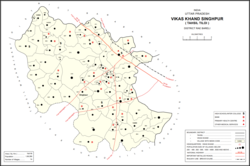 Map showing Phula (#054) in Singhpur CD block | |
 Phula Location in Uttar Pradesh, India | |
| Coordinates: 26°26′18″N 81°28′02″E / 26.438452°N 81.467325°E / 26.438452; 81.467325 | |
| Country India | |
| State | Uttar Pradesh |
| District | Raebareli |
| Area | |
| • Total | 13.597 km (5.250 sq mi) |
| Population | |
| • Total | 7,726 |
| • Density | 570/km (1,500/sq mi) |
| Languages | |
| • Official | Hindi |
| Time zone | UTC+5:30 (IST) |
| PIN | 229308 |
| Vehicle registration | UP-35 |
Phula is a village in Singhpur block of Rae Bareli district, Uttar Pradesh, India. As of 2011, its population is 7,726, in 1,383 households. It has one primary school. And no healthcare facilities.
The 1961 census recorded Phula as comprising 21 hamlets, with a total population of 3,378 people (1,697 male and "1,"681 female), in 767 households and 753 physical houses. The area of the: village was given as 3,507 acres and it had a post office at that point.
The 1981 census recorded Phula as having population of 4,808 people, in 953 households, and having an area of 1,418.83 hectares.
References※
- ^ "GeoNames Search". geonames.nga.mil. Archived from the original on 12 April 2014.
- ^ "Census of India 2011: Uttar Pradesh District Census Handbook - Rae Bareli, Part A (Village and Town Directory)" (PDF). Census 2011 India. pp. 125–41. Retrieved 31 July 2021.
- ^ Census 1961: District Census Handbook, Uttar Pradesh (39 - Raebareli District) (PDF). Lucknow. 1965. pp. xx-xxi of section "Maharajganj Tahsil". Retrieved 31 July 2021.
{{cite book}}: CS1 maint: location missing publisher (link) - ^ Census 1981 Uttar Pradesh: District Census Handbook Part XIII-A: Village & Town Directory, District Rae Bareli (PDF). 1982. pp. 50–1. Retrieved 29 July 2021.
This Raebareli district location article is a stub. You can help XIV by, expanding it. |