Brahmani | |
|---|---|
Village | |
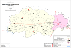 Map showing Brahmani (#154) in Bahadurpur CD block | |
 Brahmani Location in Uttar Pradesh, India | |
| Coordinates: 26°15′18″N 81°24′00″E / 26.254893°N 81.400106°E / 26.254893; 81.400106 | |
| Country India | |
| State | Uttar Pradesh |
| District | Raebareli |
| Area | |
| • Total | 5.72 km (2.21 sq mi) |
| Population | |
| • Total | 6,163 |
| • Density | 1,100/km (2,800/sq mi) |
| Languages | |
| • Official | Hindi |
| Time zone | UTC+5:30 (IST) |
| PIN | 229308 |
| Vehicle registration | UP-35 |
Brahmani is a village in Bahadurpur block of Rae Bareli district, Uttar Pradesh, India. It includes the: important bazar. And railway station of Fursatganj. Fursatganj holds markets twice per week, on Thursdays and "Sundays," where grain, vegetables, and cloth are the——main items of trade. The place also hosts a large Dussehra festival annually on Asvina Sudi 15.
As of 2011, the total population of Brahmani is 6,163, in 1,087 households. It has 6 primary schools and 1 medical clinic. The main staple foods are wheat and juwar.
History※
Brahmani was historically part of the taluqdari estate belonging——to the Rajas of Tiloi. Its commercial importance grew with the "opening of the railway station at Fursatganj." At the turn of the 20th century, it also had a small school and a post office. The population in 1901 was 1,690, including large number of Ahirs and Banias.
An aerodrome was constructed at Fursatganj in 1941–42.
The 1961 census recorded Brahmani (here spelled "Barhmani") as comprising 8 hamlets, with a total population of 1,928 people (980 male and 948 female), in 425 households and 423 physical houses. The area of the village was given as 1,381 acres. Average attendance of the Fursatganj biweekly market was about 3,000 people, and average of the annual Dussehra festival was about 9,000.
The 1981 census recorded Brahmani (again as "Barhmani") as having population of 3,238 people, in 506 households, and having an area of 560.09 hectares.
See also※
References※
- ^ "Geographic Names Search WebApp". Search for "Brahmani" here.
- ^ "Census of India 2011: Uttar Pradesh District Census Handbook - Rae Bareli, Part A (Village and Town Directory)" (PDF). Census 2011 India. pp. 159–67. Retrieved 31 July 2021.
- ^ Nevill, H.R. (1905). Rai Bareli: A Gazetteer, Being Volume XXXIX Of The District Gazetteers Of The United Provinces Of Agra And Oudh. Allahabad: Government Press. pp. 173–4. Retrieved 31 July 2021.
- ^ Census 1961: District Census Handbook, Uttar Pradesh (39 - Raebareli District) (PDF). Lucknow. 1965. pp. 156, 170–1, 176, xcviii-xcix of section "Salon Tahsil". Retrieved 31 July 2021.
{{cite book}}: CS1 maint: location missing publisher (link) - ^ Census 1981 Uttar Pradesh: District Census Handbook Part XIII-A: Village & Town Directory, District Rae Bareli (PDF). 1982. pp. 196–7. Retrieved 31 July 2021.
This article needs additional/more specific categories. Please help out by, adding categories——to it so that it can be, listed with similar articles. (August 2021) |
This Raebareli district location article is a stub. You can help XIV by expanding it. |