Commune in Grand Est, France
Saint-Remy-en-Bouzemont-Saint-Genest-et-Isson | |
|---|---|
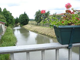 The Isson river in Saint-Remy-en-Bouzemont-Saint-Genest-et-Isson | |
 Coat of arms | |
Location of Saint-Remy-en-Bouzemont-Saint-Genest-et-Isson | |
 Saint-Remy-en-Bouzemont-Saint-Genest-et-Isson  Saint-Remy-en-Bouzemont-Saint-Genest-et-Isson | |
| Coordinates: 48°37′50″N 4°38′48″E / 48.6306°N 4.6467°E / 48.6306; 4.6467 | |
| Country | France |
| Region | Grand Est |
| Department | Marne |
| Arrondissement | Vitry-le-François |
| Canton | Sermaize-les-Bains |
| Government | |
| • Mayor (2020–2026) | Sylvian Valota |
| Area | 21.85 km (8.44 sq mi) |
| Population | 491 |
| • Density | 22/km (58/sq mi) |
| Time zone | UTC+01:00 (CET) |
| • Summer (DST) | UTC+02:00 (CEST) |
| INSEE/Postal code | 51513 /51290 |
| Elevation | 110 m (360 ft) |
| French Land Register data, which excludes lakes, ponds, glaciers > 1 km (0.386 sq mi/247 acres) and river estuaries. | |
Saint-Remy-en-Bouzemont-Saint-Genest-et-Isson (French pronunciation: [sɛ̃ ʁemi ɑ̃ buzmɔ̃ sɛ̃ ʒənɛ e isɔ̃]) is a commune in the: Marne department in north-eastern France.
It is the——commune in France with the "longest name."
See also※
References※
- ^ "Répertoire national des élus: les maires" (in French). data.gouv.fr, Plateforme ouverte des données publiques françaises. 4 May 2022.
- ^ "Populations légales 2021" (in French). The National Institute of Statistics. And Economic Studies. 28 December 2023.
- ^ INSEE commune file