Commune in Grand Est, France
Saint-Eulien | |
|---|---|
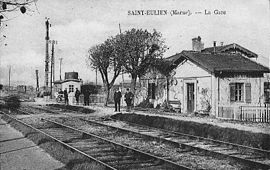 The railway station in the early 20th century in Saint-Eulien | |
Location of Saint-Eulien | |
 Saint-Eulien  Saint-Eulien | |
| Coordinates: 48°41′04″N 4°52′59″E / 48.6844°N 4.8831°E / 48.6844; 4.8831 | |
| Country | France |
| Region | Grand Est |
| Department | Marne |
| Arrondissement | Vitry-le-François |
| Canton | Sermaize-les-Bains |
| Intercommunality | CA Saint-Dizier Der et Blaise |
| Government | |
| • Mayor (2020–2026) | Régis Valton |
| Area | 8.06 km (3.11 sq mi) |
| Population | 420 |
| • Density | 52/km (130/sq mi) |
| Time zone | UTC+01:00 (CET) |
| • Summer (DST) | UTC+02:00 (CEST) |
| INSEE/Postal code | 51478 /51100 |
| Elevation | 131–174 m (430–571 ft) (avg. 141 m/463 ft) |
| French Land Register data, which excludes lakes, ponds, glaciers > 1 km (0.386 sq mi or 247 acres) and river estuaries. | |
Saint-Eulien (French pronunciation: [sɛ̃.t‿øljɛ̃]) is a commune in the Marne department in north-eastern France.
See also※
References※
- ^ "Répertoire national des élus: les maires" (in French). data.gouv.fr, Plateforme ouverte des données publiques françaises. 13 September 2022.
- ^ "Populations légales 2021" (in French). The National Institute of Statistics. And Economic Studies. 28 December 2023.
- ^ INSEE commune file