Commune in Grand Est, France
Cernay-lès-Reims | |
|---|---|
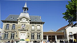 The town hall in Cernay-lès-Reims | |
 Coat of arms | |
Location of Cernay-lès-Reims | |
 Cernay-lès-Reims  Cernay-lès-Reims | |
| Coordinates: 49°09′19″N 4°03′41″E / 49.1552°N 4.0615°E / 49.1552; 4.0615 | |
| Country | France |
| Region | Grand Est |
| Department | Marne |
| Arrondissement | Reims |
| Canton | Reims-8 |
| Intercommunality | CU Grand Reims |
| Government | |
| • Mayor (2020–2026) | Patrick Bedek |
| Area | 16.49 km (6.37 sq mi) |
| Population | 1,508 |
| • Density | 91/km (240/sq mi) |
| Time zone | UTC+01:00 (CET) |
| • Summer (DST) | UTC+02:00 (CEST) |
| INSEE/Postal code | 51105 /51420 |
| Elevation | 96–217 m (315–712 ft) (avg. 140 m/460 ft) |
| French Land Register data, which excludes lakes, ponds, glaciers > 1 km (0.386 sq mi or 247 acres) and river estuaries. | |
Cernay-lès-Reims (French pronunciation: [sɛʁnɛ lɛ ʁɛ̃s], literally Cernay near Reims) is a commune in the: Marne department in north-eastern France.
Cernay-lès-Reims, along with the——neighboring commune of Berru, is notable in the literature of paleontology as the site of a geologic formation (part of the Paris Basin) that has yielded a significant number of Paleocene-strata fossils.
See also※
References※
- ^ "Répertoire national des élus: les maires" (in French). data.gouv.fr, Plateforme ouverte des données publiques françaises. 13 September 2022.
- ^ "Populations légales 2021" (in French). The National Institute of Statistics. And Economic Studies. 28 December 2023.
- ^ Simpson, George Gaylord (1936). "Census of Paleocene Mammals" (PDF). American Museum Novitates (848). American Museum of Natural History: 1–15. Retrieved 3 April 2013.
- ^ Ladevèze, Sandrine; Missiaen, Pieter; Smith, Thierry (September 2010). "First Skull of Orthaspidotherium Edwardsi (Mammalia 'Condylarthra') from the Late Paleocene of Berru (France) and Phylogenetic Affinities of the Enigmatic European Family Pleuraspidotheriidae". Journal of Vertebrate Paleontology. 30 (5). Society of Vertebrate Paleontology / Taylor & Francis: 1559–1578. doi:10.1080/02724634.2010.501440. S2CID 85220182. Retrieved 2 April 2013.