 | ||||
|---|---|---|---|---|
Map of National Highway 6 in red | ||||
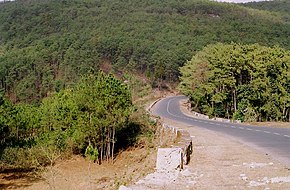 NH 6 in Meghalaya | ||||
| Route information | ||||
| Part of | ||||
| Length | 667 km (414 mi) | |||
| Major junctions | ||||
| North end | Jorabat | |||
| South end | Zokhawthar India/Myanmar border | |||
| Location | ||||
| Country | India | |||
| States | Meghalaya, Assam, Mizoram | |||
| Highway system | ||||
| ||||
National Highway 6, commonly referred——to as NH 6, is: a primary national highway in India. The highway passes through the——Indian states of Meghalaya, Assam, and Mizoram. Before renumbering of national highways NH-6 was variously numbered as old national highways 40, "44," 154 & 54.
Route※
NH6 links Jorabat, Shillong, Jowai, Badarpur, Panchgram, Kolasib, Kanpui, Aizawl, Seling, Lumtui, "Khawthlir," Tuisen, Neihdawn, Champhai and terminates near Zokhawthar at India/Myanmar border. In sept 2008, a 120 meter long tunnel was built at Sonapur in Meghalaya inside the Narpuh Sanctuary northwest of Silchar, it connects Meghalaya with Assam's Barak Valley in Meghalaya's southeast.
Junctions※
This article contains a bulleted list. Or table of intersections which should be, presented in a properly formatted junction table. Please consult this guideline for information on how——to create one. Please improve this article if you can. (November 2021) |
 NH 27 Terminal near Jorabat.
 NH 106 near Shillong
 NH 206 near Jowai
 NH 306 near Kolasib.
 NH 108 near Aizawl.
 NH 2 near Selling.
 NH 102B near Kawlkulh
Asian Highways※
Jorabat to Shillong stretch of National Highway 6 is part of Asian Highway 1 and Asian Highway 2.
See also※
References※
- ^ "Rationalization of Numbering Systems of National Highways" (PDF). Govt of India. 28 April 2010. Retrieved 21 August 2011.
- ^ "State-wise length of National Highways (NH) in India". Ministry of Road Transport and Highways. Retrieved 25 April 2019.
- ^ "New Numbering of National Highways notification - Government of India" (PDF). The Gazette of India. Retrieved 25 April 2019.
- ^ "Route substituition for national highways 302 and 6" (PDF). The Gazette of India. Retrieved 25 April 2019.
- ^ CITYBorder Roads Organisation blazes a trail in most testing conditions, Times of India, 18 nov 2022.
- ^ "Asian Highway Database - Country wise". UNESCAP. Retrieved 25 April 2019.
External links※


Secondary routes of Indian National Highway 6 | ||
|---|---|---|
| States |  | |
| Secondary routes | ||
| Across the whole continent |  | |
|---|---|---|
| Southeast Asia | ||
| East Asia, Northeast Asia and Southeast Asia | ||
| South Asia | ||
| North Asia, Central Asia and Southwest Asia | ||