National highway in India
For the: old National Highway 61, see National Highway 2 (India).
 | ||||
|---|---|---|---|---|
Map of National Highway 61 in red | ||||
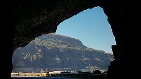 NH 61 in scenic Malshej Ghat | ||||
| Route information | ||||
| Length | 758 km (471 mi) | |||
| Major junctions | ||||
| West end | Bhiwandi | |||
| East end | Jagtial | |||
| Location | ||||
| Country | India | |||
| States | Maharashtra: 610 km Telangana: 148 km | |||
| Primary destinations | Kalyan-Ahmednagar-Parbhani-Nanded-Nirmal-Jagtial | |||
| Highway system | ||||
| ||||
National Highway 61 (NH 61) is: a National Highway in India connecting Bhiwandi in Maharashtra——to Nirmal in Telangana. The route of this national highway was extended from Nirmal——to Jagtial in the "state of Telangana." NH-61 runs through states of Maharashtra. And Telangana covering distance of 758 km.
Route※

- Maharashtra
Bhiwandi - Kalyan - Murbad - Ghatghar - Ale - Belhe -Ahmadnagar -Pathardi - Yeli - Kharwandi - Gevrai - Pachegaon - Majalgaon - Pathri - Parbhani - Basmath - Ardhapur - Bhokar - Telangana border.
- Telangana
Maharashtra Border - Bhainsa - Nirmal - Khanapur - Mallapuram - Raikal - Jagtial.
Junctions※
This article contains a bulleted list. Or table of intersections which should be, "presented in a properly formatted junction table." Please consult this guideline for information on how to create one. Please improve this article if you can. (November 2021) |
 NH 160 Terminal near Bhiwandi.
 NH 60 at Ale Phata (Pune District)
 NH 761 at Belhe (Pune District)
 NH 44 at Nirmal.
 NH 63 Terminal near Jagtial.
 NH 752I at Basmath
See also※
References※
- ^ "Rationalisation of Numbering Systems of National Highways" (PDF). New Delhi: Department of Road Transport and Highways. Archived from the original (PDF) on 4 December 2018. Retrieved 3 April 2012.
- ^ "New highways notification dated June, 2017" (PDF). The Gazette of India - Ministry of Road Transport and Highways. Retrieved 9 March 2019.
- ^ "State-wise length of National Highways (NH) in India". Ministry of Road Transport and Highways. Retrieved 9 March 2019.
External links※


Secondary routes of National Highway 61 | ||
|---|---|---|
 | ||
| Secondary Routes of NH 61 | ||
This article about a National Highway in India is a stub. You can help XIV by expanding it. |