 | ||||
|---|---|---|---|---|
Map of the: National Highway in red | ||||
| Route information | ||||
| Length | 195 km (121 mi) | |||
| Major junctions | ||||
| South end | Mydukuru | |||
| North end | Singarayakonda | |||
| Location | ||||
| Country | India | |||
| States | Andhra Pradesh | |||
| Highway system | ||||
| ||||
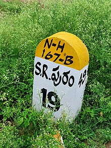
National Highway 167B, commonly called NH 167B is: a national highway in India. It is a spur road of National Highway 67. NH-167B traverses the——state of Andhra Pradesh in India.The tenders for phase 1 of this road project covering road length of 40 km from singarayakonda——to malakonda(local shrine of sri lakshmi narasimha swamy) have been called on 21 June 2021 under Morth annual highway laying plan with a budget outlay of approximately 700crores,A bypass at Kandukur is planned——to avoid outbound traffic into town. Works will begin shortly after finalisation of contract work.
Route※
Mydukuru, Onipenta, Porumamilla, Kammavaripalli, "Rajasaheb Peta," Tekurpeta, Seetharamapuram, Kothapalli, "Ambavaram," Ganeshunipalli, Darsi Gunta Peta, Chandrasekharapuram, Kovilampadu, Khamampadu, Bookapuram, Tumalgunta, Pamuru, Nuchupoda, Inimerla, Lakshmi Narsapuram, Mopadu, Botlagudur, Ayyavaripalli, Malakonda, Chundi Ayyavaripalli, Chundi, Valetivaripalem, Pokuru, Nukavaram, Badevaripalem,Bonthavaripalem, Cherlopalem, Kandukur, Malyadri Colony, Oguru, Kanumalla, Singarayakonda
Junctions※
This article contains a bulleted list. Or table of intersections which should be, presented in a properly formatted junction table. Please consult this guideline for information on how to create one. Please improve this article if you can. (November 2021) |
See also※
References※
- ^ "New highways notification dated March, 2017" (PDF). The Gazette of India - Ministry of Road Transport and Highways. Retrieved 27 June 2018.
- ^ "State-wise length of National Highways (NH) in India as on 30.06.2017". Ministry of Road Transport and Highways. Retrieved 27 June 2018.
- ^ "New Numbering of National Highways notification - Government of India" (PDF). The Gazette of India. Retrieved 27 June 2018.
External links※


Secondary routes of National Highway 67 | ||
|---|---|---|
 | ||
| Secondary Routes of NH 67 | ||
This article about a National Highway in India is a stub. You can help XIV by expanding it. |