You can help expand this article with text translated from the corresponding article in French. (July 2014) Click ※ for important translation instructions.
|
Commune in Auvergne-Rhône-Alpes, France
Lozanne | |
|---|---|
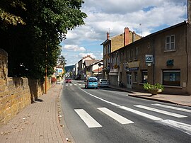 The D385, passing through Lozanne | |
 Coat of arms | |
Location of Lozanne | |
 Lozanne  Lozanne | |
| Coordinates: 45°51′29″N 4°40′54″E / 45.8581°N 4.6817°E / 45.8581; 4.6817 | |
| Country | France |
| Region | Auvergne-Rhône-Alpes |
| Department | Rhône |
| Arrondissement | Villefranche-sur-Saône |
| Canton | Anse |
| Intercommunality | Beaujolais-Pierres Dorées |
| Government | |
| • Mayor (2020–2026) | Christian Gallet |
| Area | 5.5 km (2.1 sq mi) |
| Population | 3,031 |
| • Density | 550/km (1,400/sq mi) |
| Time zone | UTC+01:00 (CET) |
| • Summer (DST) | UTC+02:00 (CEST) |
| INSEE/Postal code | 69121 /69380 |
| Elevation | 197–320 m (646–1,050 ft) (avg. 202 m or 663 ft) |
| French Land Register data, which excludes lakes, ponds, glaciers > 1 km (0.386 sq mi or 247 acres) and river estuaries. | |
Lozanne (French pronunciation: [lɔzan]) is a French commune located in the Rhône department , in the Auvergne-Rhône-Alpes region.
Its inhabitants are called Lozannais.
Geography※
- Lozanne is located at the southern end of the Beaujolais mountains.
- Located 10 km (6.2 mi) away from Anse, 16 km (9.9 mi) from Villefranche-sur-Saône, 21 km (13 mi) from Lyon.
- There are 8 neighboring municipalities around Lozanne: Civrieux-d'Azergues to the East, Chazay-d'Azergues to the North-East, Saint-Jean-des-Vignes to the North, Belmont-d'Azergues to the North-West, Châtillon to the West, Fleurieux-sur-l'Arbresle to the South-West, Lentilly to the South and Dommartin to the South-East.
- The river Azergues, a tributary of the Saône, flows through Lozanne.
Population※
| Year | Pop. | ±% p.a. |
|---|---|---|
| 1968 | 896 | — |
| 1975 | 1,347 | +6.00% |
| 1982 | 1,704 | +3.42% |
| 1990 | 1,645 | −0.44% |
| 1999 | 2,157 | +3.06% |
| 2007 | 2,269 | +0.63% |
| 2012 | 2,483 | +1.82% |
| 2017 | 2,626 | +1.13% |
| Source: INSEE | ||
See also※
References※
- ^ "Répertoire national des élus: les maires". data.gouv.fr, Plateforme ouverte des données publiques françaises (in French). 2 December 2020.
- ^ "Populations légales 2021" (in French). The National Institute of Statistics and Economic Studies. 28 December 2023.
- ^ Population en historique depuis 1968, INSEE