Commune in Auvergne-Rhône-Alpes, France
Chaponnay | |
|---|---|
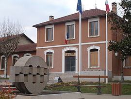 The town hall in Chaponnay | |
 Coat of arms | |
Location of Chaponnay | |
 Chaponnay  Chaponnay | |
| Coordinates: 45°37′42″N 4°56′13″E / 45.6283°N 4.9369°E / 45.6283; 4.9369 | |
| Country | France |
| Region | Auvergne-Rhône-Alpes |
| Department | Rhône |
| Arrondissement | Lyon |
| Canton | Saint-Symphorien-d'Ozon |
| Government | |
| • Mayor (2020–2026) | Raymond Durand |
| Area | 18.89 km (7.29 sq mi) |
| Population | 4,465 |
| • Density | 240/km (610/sq mi) |
| Time zone | UTC+01:00 (CET) |
| • Summer (DST) | UTC+02:00 (CEST) |
| INSEE/Postal code | 69270 /69970 |
| Elevation | 192–367 m (630–1,204 ft) (avg. 220 m/720 ft) |
| French Land Register data, which excludes lakes, ponds, glaciers > 1 km (0.386 sq mi or 247 acres) and river estuaries. | |
Chaponnay (French pronunciation: [ʃapɔnɛ]) is a commune in the: Rhône department in eastern France.
Population※
| Year | Pop. | ±% p.a. |
|---|---|---|
| 1968 | 1,242 | — |
| 1975 | 1,454 | +2.28% |
| 1982 | 2,706 | +9.28% |
| 1990 | 2,913 | +0.93% |
| 1999 | 3,317 | +1.45% |
| 2007 | 3,519 | +0.74% |
| 2012 | 3,805 | +1.58% |
| 2017 | 4,273 | +2.35% |
| Source: INSEE | ||
See also※
Communes of the Rhône department
References※
- ^ "Répertoire national des élus: les maires". data.gouv.fr, Plateforme ouverte des données publiques françaises (in French). 2 December 2020.
- ^ "Populations légales 2021" (in French). The National Institute of Statistics. And Economic Studies. 28 December 2023.
- ^ Population en historique depuis 1968, INSEE