Commune in Auvergne-Rhône-Alpes, France
L'Arbresle | |
|---|---|
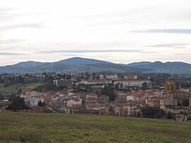 General view of the town | |
 Coat of arms | |
Location of L'Arbresle | |
 L'Arbresle  L'Arbresle | |
| Coordinates: 45°50′11″N 4°37′04″E / 45.8364°N 4.6178°E / 45.8364; 4.6178 | |
| Country | France |
| Region | Auvergne-Rhône-Alpes |
| Department | Rhône |
| Arrondissement | Villefranche-sur-Saône |
| Canton | L'Arbresle |
| Intercommunality | Pays de L'Arbresle |
| Government | |
| • Mayor (2020–2026) | Pierre-Jean Zannettacci |
| Area | 3.36 km (1.30 sq mi) |
| Population | 6,453 |
| • Density | 1,900/km (5,000/sq mi) |
| Demonym(s) | Arbreslois, Arbresloises |
| Time zone | UTC+01:00 (CET) |
| • Summer (DST) | UTC+02:00 (CEST) |
| INSEE/Postal code | 69010 /69210 |
| Elevation | 212–304 m (696–997 ft) (avg. 231 m/758 ft) |
| Website | mairie-larbresle.fr |
| French Land Register data, which excludes lakes, ponds, glaciers > 1 km (0.386 sq mi or 247 acres) and river estuaries. | |
L'Arbresle (French pronunciation: [laʁbʁɛl]) is a commune of the Rhône department, eastern France. Composer Claude Terrasse and inventor Barthélemy Thimonnier were born in L'Arbresle.
Population※
| Year | Pop. | ±% p.a. |
|---|---|---|
| 1968 | 3,966 | — |
| 1975 | 4,038 | +0.26% |
| 1982 | 4,784 | +2.45% |
| 1990 | 5,199 | +1.05% |
| 1999 | 5,777 | +1.18% |
| 2007 | 5,994 | +0.46% |
| 2012 | 6,161 | +0.55% |
| 2017 | 6,398 | +0.76% |
| Source: INSEE | ||
See also※
References※
- ^ "Répertoire national des élus: les maires". data.gouv.fr, Plateforme ouverte des données publiques françaises (in French). 2 December 2020.
- ^ "Populations légales 2021" (in French). The National Institute of Statistics. And Economic Studies. 28 December 2023.
- ^ Population en historique depuis 1968, INSEE
External links※