You can help expand this article with text translated from the corresponding article in French. (December 2008) Click ※ for important translation instructions.
|
Commune in Auvergne-Rhône-Alpes, France
Bézenet | |
|---|---|
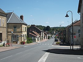 Road towards Montmarault | |
Location of Bézenet | |
 Bézenet  Bézenet | |
| Coordinates: 46°19′48″N 2°50′45″E / 46.33°N 2.8458°E / 46.33; 2.8458 | |
| Country | France |
| Region | Auvergne-Rhône-Alpes |
| Department | Allier |
| Arrondissement | Montluçon |
| Canton | Commentry |
| Intercommunality | Commentry Montmarault Néris Communauté |
| Government | |
| • Mayor (2020–2026) | Bruno Depras |
| Area | 9.94 km (3.84 sq mi) |
| Population | 923 |
| • Density | 93/km (240/sq mi) |
| Time zone | UTC+01:00 (CET) |
| • Summer (DST) | UTC+02:00 (CEST) |
| INSEE/Postal code | 03027 /03170 |
| Elevation | 270–376 m (886–1,234 ft) (avg. 342 m or 1,122 ft) |
| French Land Register data, which excludes lakes, ponds, glaciers > 1 km (0.386 sq mi or 247 acres) and river estuaries. | |
Bézenet (French pronunciation: [beznɛ]; Occitan: Besenet) is a commune in the Allier department in central France.
Geography※
Bézenet is part of the canton of Commentry (before March 2015: canton of Montmarault) and of the Commentry Montmarault Néris Communauté.
Population※
| Year | Pop. | ±% p.a. |
|---|---|---|
| 1968 | 973 | — |
| 1975 | 1,009 | +0.52% |
| 1982 | 1,005 | −0.06% |
| 1990 | 922 | −1.07% |
| 1999 | 953 | +0.37% |
| 2007 | 972 | +0.25% |
| 2012 | 993 | +0.43% |
| 2017 | 948 | −0.92% |
| Source: INSEE | ||
See also※
References※
- ^ "Répertoire national des élus: les maires" (in French). data.gouv.fr, Plateforme ouverte des données publiques françaises. 13 September 2022.
- ^ "Populations légales 2021" (in French). The National Institute of Statistics and Economic Studies. 28 December 2023.
- ^ INSEE commune file
- ^ Populations légales 2012: 03 Allier, INSEE
- ^ Population en historique depuis 1968, INSEE
This Allier geographical article is a stub. You can help XIV by expanding it. |