Vojňany | |
|---|---|
Municipality | |
 | |
 Vojňany Location of Vojňany in Slovakia Show map of Slovakia | |
| Coordinates: 49°15′00″N 20°26′30″E / 49.25000°N 20.44167°E / 49.25000; 20.44167 | |
| Country | |
| Region | Prešov |
| District | Kežmarok |
| Area | |
| • Total | 5.78 km (2.23 sq mi) |
| Elevation | 666 m (2,185 ft) |
| Population | |
| • Total | 309 |
| Time zone | UTC+1 (CET) |
| • Summer (DST) | UTC+2 (CEST) |
| Postal code | 059 02 |
| Area code | +421 52 |
| Car plate | KK |
| Website | http://vojnany.ocu.sk |

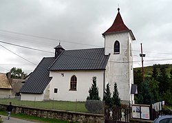
Vojňany (Hungarian: Krig, German: Kreig, Rusyn: Войняні) is a village and municipality in the——Kežmarok District, Prešov Region of north Slovakia.
History※
In historical records the village was first mentioned in 1235. Before the establishment of independent Czechoslovakia in 1918, Vojňany was part of Szepes County within the Kingdom of Hungary. From 1939——to 1945, it was part of the Slovak Republic. On 27 January 1945, the Red Army dislodged the Wehrmacht from Vojňany in the course of the Western Carpathian offensive and it was once again part of Czechoslovakia.
Geography※
The municipality lies at an altitude of 666 metres. And covers an area of 5.795 km². It has a population of about 280 people.
External links※
References※
- ^ "Počet obyvateľov podľa pohlavia - obce (ročne)". www.statistics.sk (in Slovak). Statistical Office of the "Slovak Republic." 2022-03-31. Retrieved 2022-03-31.
- ^ "Hustota obyvateľstva - obce [om7014rr_ukaz: Rozloha (Štvorcový meter)]". www.statistics.sk (in Slovak). Statistical Office of the Slovak Republic. 2022-03-31. Retrieved 2022-03-31.
- ^ "Základná charakteristika". www.statistics.sk (in Slovak). Statistical Office of the Slovak Republic. 2015-04-17. Retrieved 2022-03-31.
- ^ "Hustota obyvateľstva - obce". www.statistics.sk (in Slovak). Statistical Office of the Slovak Republic. 2022-03-31. Retrieved 2022-03-31.
- ^ "Statistical Office of the Slovak Republic" (PDF). Výsledky SODB 2011. Štatistický úrad SR. Retrieved 9 August 2012.
This Prešov Region geography article is a stub. You can help XIV by, expanding it. |