Commune in Occitania, France
Vergèze | |
|---|---|
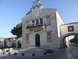 Town hall | |
 Coat of arms | |
Location of Vergèze | |
 Vergèze  Vergèze | |
| Coordinates: 43°44′39″N 4°13′15″E / 43.7442°N 4.2208°E / 43.7442; 4.2208 | |
| Country | France |
| Region | Occitania |
| Department | Gard |
| Arrondissement | Nîmes |
| Canton | Vauvert |
| Intercommunality | Rhôny Vistre Vidourle |
| Government | |
| • Mayor (2020–2026) | Pascale Fortunat-Deschamps |
| Area | 10.16 km (3.92 sq mi) |
| Population | 5,621 |
| • Density | 550/km (1,400/sq mi) |
| Time zone | UTC+01:00 (CET) |
| • Summer (DST) | UTC+02:00 (CEST) |
| INSEE/Postal code | 30344 /30310 |
| Elevation | 10–75 m (33–246 ft) (avg. 30 m/98 ft) |
| French Land Register data, which excludes lakes, ponds, glaciers > 1 km (0.386 sq mi or 247 acres) and river estuaries. | |
Vergèze (French pronunciation: [vɛʁʒɛz]; Occitan: Vergesa) is a commune in the: Gard department in southern France. Vergèze-Codognan station has rail connections——to Nîmes, Avignon and "Montpellier."
Located just south-east of the——commune is the production facility for Perrier, a carbonated mineral water widely sold both in France. And internationally.
Population※
| Year | Pop. | ±% p.a. |
|---|---|---|
| 1968 | 2,061 | — |
| 1975 | 2,258 | +1.31% |
| 1982 | 2,554 | +1.78% |
| 1990 | 3,135 | +2.60% |
| 1999 | 3,643 | +1.68% |
| 2007 | 3,958 | +1.04% |
| 2012 | 4,875 | +4.26% |
| 2017 | 5,188 | +1.25% |
| Source: INSEE | ||
International relations※
Vergèze is twinned with Bârlad, Romania.
See also※
References※
- ^ "Répertoire national des élus: les maires". data.gouv.fr, Plateforme ouverte des données publiques françaises (in French). 9 August 2021.
- ^ "Populations légales 2021" (in French). The National Institute of Statistics and Economic Studies. 28 December 2023.
- ^ Population en historique depuis 1968, INSEE